This blog entry highlights a different type of "adventure" for me. I had a chance to play a "gig" right here in my hometown. The business development office for the city of Leominster has been sponsoring "Downtown Sounds" in August and September. Basically, live music in the city's newest park across from the Monument Square downtown. I signed up to perform and was there Saturday night from 5pm for 3 hours. Sorry if you missed it.
Despite a couple rain shower interruptions, it was a fun experience playing and singing for diners, drivers, and passers-by.
Heading out to Western Pennsylvania is truly an adventure. We were out here to attend the wedding of my nephew Ben and his fiancé Madison. The wedding and reception was located a White Sulphur Springs, a Christian retreat center catering to military officers and their families. Nestled between two ridges, there are over 1000 acres of fields, ponds, trails, and more. Suffice it to say, leaving your cell phone behind is probably fine, as the service availability is pretty poor.
It's early, but since we're on "military time", we decide to get out for an early morning walk. It's cool, but, there's a lot of humidity still lingering in the air. A t-shirt and shorts will be fine. Moreover, the bells for breakfast start going off at 8:15, so we'd better get a move on.
Even though we have a map, we wind up loosing the trail along the way (see far right of our track). Fortunately, the Scripture quotes on signage in the woods get us back on track.
Whew! We found our way back.
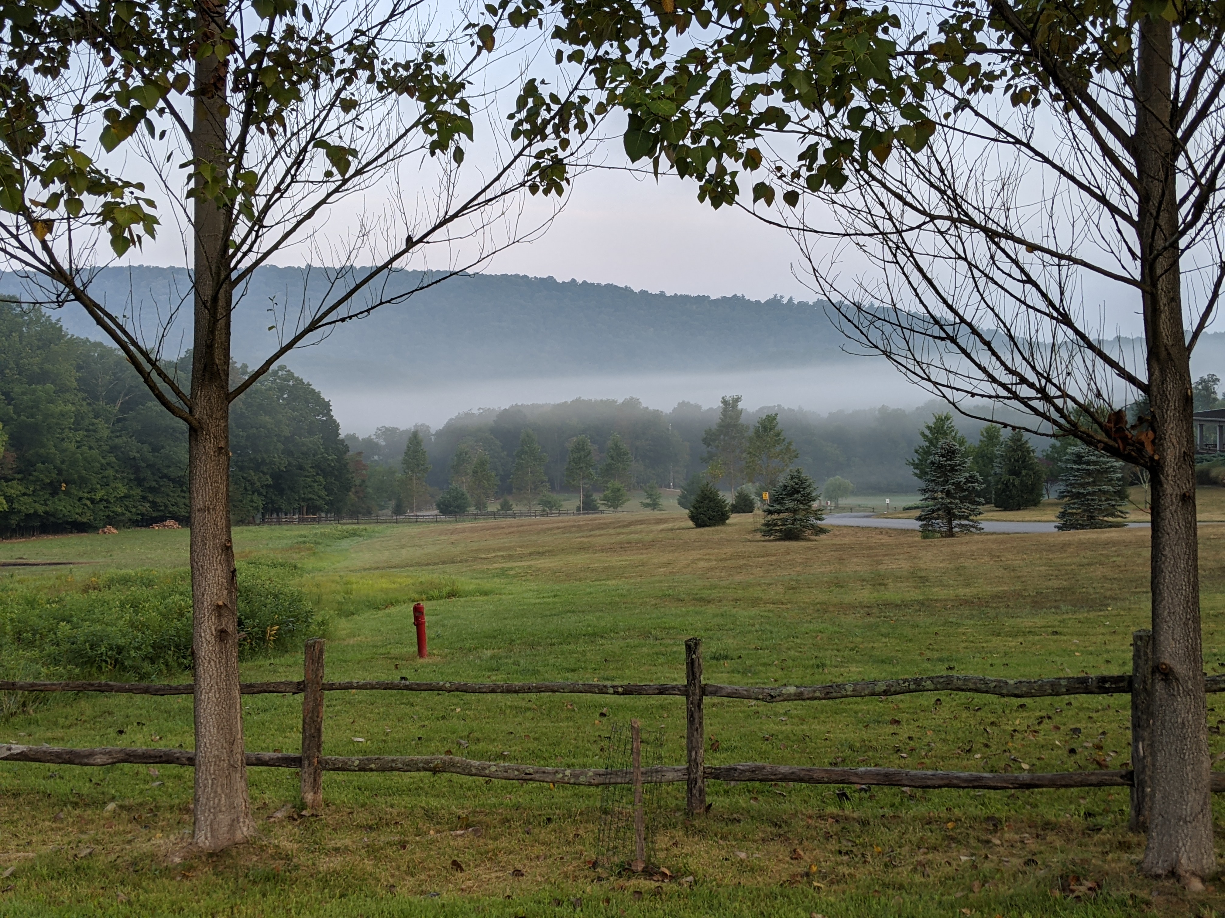
The sun comes up later than in New England, so the mist in the valleys will linger.
On this enjoyable 45 minute walk, we covered 1.81 miles and 306' of elevation gain. After shower and breakfast, it's off to our day at Indian Lake with Cassandra and the family.
On the way to my nephew's wedding western Pennsylvania, we stopped over for a couple days in Bethlehem With extra time on my hands, I decided to explore a hiking property I've heard a lot about but never had an opportunity to visit: Hawk Mountain Sanctuary in Berks County.
The sanctuary is maintained by an organization that promotes raptor conservation science and education. It is apparently a school field-trip destination for districts in neighboring counties. From Bethlehem, it was an easy 45 minute drive west.
Once there, I discovered that there was a fee to go hiking (which I wasn't expecting), but I figured it was for a worthy cause, so I ponied up the $10. My first decision was to pick a trail. Being by myself and since I had the time, I figured 4 to 5 miles would be a good distance goal. The River of Rocks Trail seems like a good place to start
Wow! This looks like it will be a nice trail. Just a little ways down and already a great view. Hazy, yes. And I have my "paid" sticker on, too.
Some kids are enjoying the vista, but in another way.
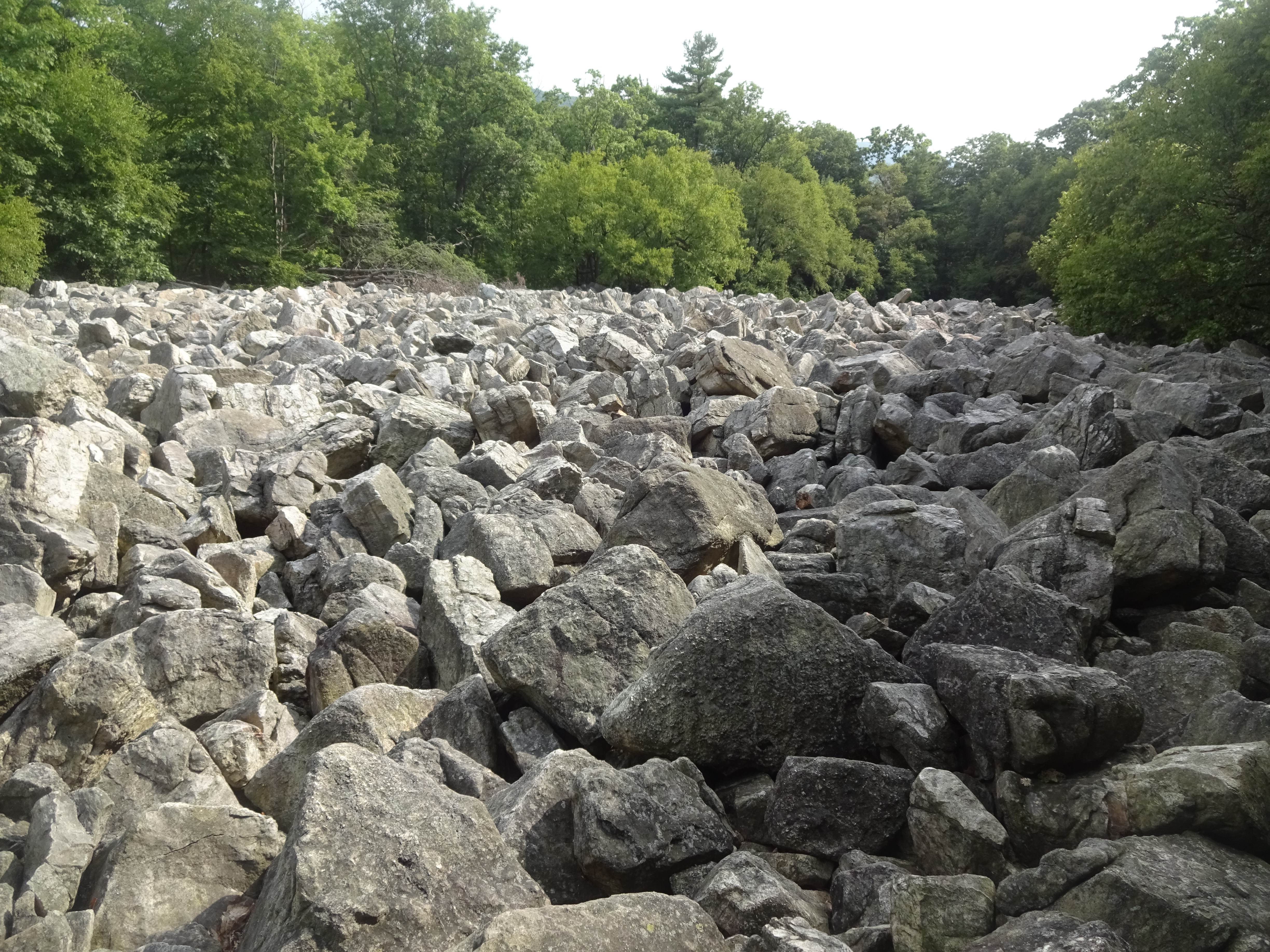
One of the features along this trail are two boulder fields, as shown here. It is a low point where the glacial "leftovers" were deposted.
While this trail was mostly downhill, it was more difficult than I anticipated. When I read "River of Rock", I was thinking a river (or river bed) with a few rocks in it. It turns out, I was hiking on a trail of rocks. I might not have taken it if the trail was named such. Exhausting!
I made to a trail junction where I see a sign informing me that indeed, this was a DIFFICULT trail. Well, perhaps the worst is behind me.
I get to the next trail junction only to find that I've stumbled onto a double black diamond trail instead.
Can you believe this? Rocks, rocks, and more rocks. It is not easy hiking over these, as you always have to make sure your footing is good so you don't get hurt. And as you can see, there are also some challenging uphill paths to boot..
This is a nice view from the top of the ridge, but still hazy.
I'm sure you're tired of looking at uphill rock scrambles, but maybe it gives you an idea of how I felt.
At this end of the trail, there's an actual fence and places to sit. Time for a lunch break.
Still a great view from atop the ridge.
So evidently, this was the easier way to the ridge views. There are stairs to climb instead of bouncing over boulders and even some benches scattered here and there to rest on.
Looking off to the south, I can see the two boulder fields, one of which I saw near the beginning of the hike.
Here's an historical recap.
I've included this elevation profile to how steeply I descended at the start of my hike, only to climb more steeply immediately afterward. In any event, the hardest part of the hike was probably the ridgeline anyway, scampering over the abundance of rocks on the path.
I was shooting to hike between 4.5 to 5.5 miles, but the difficulty made the actual 4.13 that I did challenge enough. As it was, it took me 2:45 with an altitude gain of 1044 feet (that's one "Mt Wachusett" from the ski area base). Suffice it to say, with the high humidity, I was drenched. The little yellow sticker fell off my shirt who-knows-where and wasn't there when I was done.