Saturday, October 19, 2019

Batholomew's Cobble


Today I was reminded that fall is the best season for hiking.  We had an opportunity today to go hiking with the Brooklyn side of the family.  After spending a getaway night in the Berkshires, Matt, Becky, and Madeline joined us for an outdoor adventure in extreme southwestern Massachusetts.  The location is Bartholomew's Cobble, a Trustees of Reservations property.  Since we're already members (and often take advantage of our membership at Crane Beach), we thought it would be nice to explore one of the other properties on their extensive list.

Once we settled on location, Matt did some research and planned the perfect hike for us.

Despite what the website said, the visitor's center was closed.  So, after a few adjustments, we start out along the scenic trail.  Matt had done some research and had a plan for the hike.
We walk alongside the Housatonic River which snakes back and forth here.
 The river is running pretty high right now due to some recent rains.


Madeline's having a grand time riding on Daddy's back.
There were interpretive signs along some portions of the trail.

Almost everybody in this "selfie".
In this "selfie", I include the "Rock Outcrop" which is noted prominently on the trail map.

It's not the Rockies, but there are actual mountains in the Berkshires.  
Usually one  step OVER a log that has fallen across the trail.

It's a little after 12pm at this point, and you can tell by the length of the shadows that's its autumn.
Lots and lots of fallen leaves getting stuck on the end of my trekking poles. 


This is a long path up to Hurlburt's Hill.  Grasshoppers were jumping in front of our shoes with every step.

The payoff for the climb is this great view.

With a panorama  photo, you get an even better sense of the expansive landscape.

This photo shows color and suggests texture as well.
We take a rest and snack break at the benches on the hill top.  About 50 meters behind us is the Connecticut state line.
Feeling good at the top of the hill.
 After our break, we have a straight-line walk back to the visitor's center and our car.  The hike is a modest 3.27 miles done in 2:11.  With the climb up Hurlburt's Hill, our total elevation gain as 682'.


The parking lot at the visitor's center was quite full when we arrived back.  We pack up and head into Sheffield for a late lunch.  Matt's chosen Bash Bish Brew & Que, a small establishment on the main street.  The atmosphere was laid-back and the food was very good:  brisket, pulled pork, greet beans, cole slaw, and local beer.  Betsy brought gluten free German Black Forest cupcakes to celebrate Matt's birthday.  A fitting end for a beautiful fall day in the Berkshires.

Sunday, September 15, 2019

Hub on Wheels 2019

This is the year for long city bike rides.  In the spring it was 40 miles on the Five Boro Bike Tour in New York.  Today it's 44 miles with Hub on Wheels here in Boston.  There are a few differences between the rides.  First of all, since this one's in Boston, it's a lot closer to home.  Instead of driving 4 hours to another city the day before, I got to sleep in my own bed before the big adventure.  Even better, instead of rain and showers, it's a blue bird day here in New England.  However, just like in the spring, Matt & I are doing this ride together. To add to the fun, though, we're joining several cyclists from the Veracode Burlington office.

For my part, I am nursing a knee injury suffered in an after-work volleyball game a few days earlier.  Hopefully, it won't hold me back today.

Matt didn't receive his info packet in time, so we need to go to registration in City Hall Plaza before we start.  After that, we look for our friends.

Matt & I are ready to go.  Little did I realize when I took this picture that we were right in front of the Old State House.
Some friends and coworkers:  Yun, Ryan (back turned), Kate, and Matt.

Kate & I must have registered at the same time;  her bib number (1625) is one number after mine (1624).
Looking down State Street past the Old State House, you can also see the Boston Custom House Tower against the sky.

The ride begins and we turn left onto Congress Street cutting between City Hall on the left and Fanieuil Hall on the right.  From there we head out onto Storrow Drive along the Charles River.  Sorry, no pictures here - there were lots and lots of bikes and people, but beautiful view of the river, the Esplanade, and Boston University. 
We turn off at The Back Bay Fens and start down the Emerald Necklace.
Our first rest stop is at in Arnold Arboretum about Mile 13.5.  We catch up with Kate for the first time.

This bridge wasn't too far after the rest stop, not sure exactly where, or if it has a name,
 but, I thought it was pretty neat looking.
The second rest stop is  at Neponset Park, just short of Mile 30.
There we found granola and energy bars, fresh fruit, and lines for the port-a-potties.
Next we're off to Pope John Paul II Park then heading onto the UMass Boston campus.

Reaching Columbia point, I take a picture break at the JFK Library where I visited last February.
I've seen this iconic building from the water several times paddling in Dorchester Bay, but never this close before.
From here, you get a great view of the city skyline.

Our third rest stop is at Carson Beach Mile 36.5.

We fell behind Kate and Ryan a bit and planned to meet them here.  Unfortunately, we couldn't find them,
but apparently they were here waiting for us just to the left of this photo.
From here, we're off into Southie, past City Point beach, another one of my paddling put-in spots for Boston Harbor.
We saw Serenade of the Seas when we passed the Black Falcon Cruise Terminal, before riding into the seaport district.
This is the view up Seaport Boulevard.

We've had to obey the stoplights along the route, but now that we're back downtown, there's a lot more of them.
We cross the finish line back at City Hall Plaza, where we view vendors and food stations. 
We wait in line for our free burrito bowl.  It was worth the wait.


Another nice medallion to hang on my dining room lamp.  Just slightly bigger than the one from NYC.
Maybe because it was a few miles more.
My hyperextended knee didn't hold me back at all today.  Moreover,  I may have enjoyed this ride even more than the one in the spring; I'm sure the weather had something to do with that.  But even more than that, I got to see so many cool places that I've visited for other reasons or heard about and now finally got a chance to see.

Saturday, August 10, 2019

AMC Paddle - Barn Island

I haven't had a chance to paddle with Barry and the AMC Connecticut chapter for a couple years, so I welcomed this opportunity to explore another part of the shoreline of the southeast coast.  As it turned out, this was a two-state excursion. 

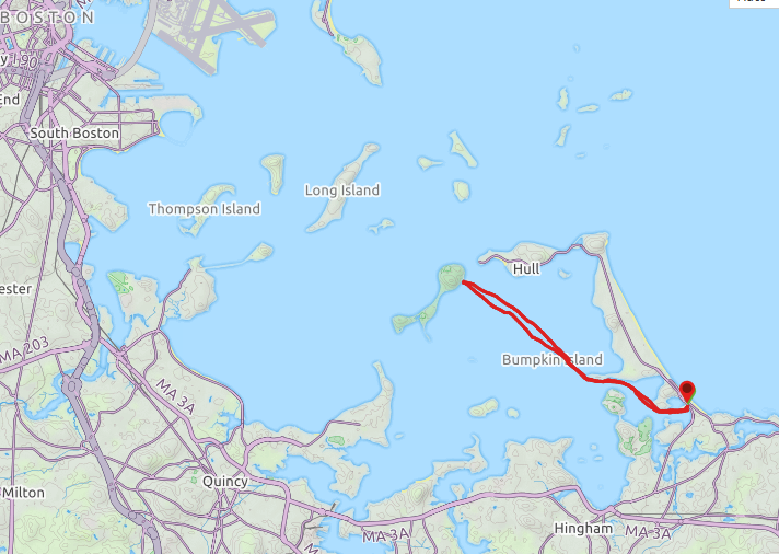
Betsy and Peggy came along, not to paddle, but to spend the day in nearby Mystic for shopping and  an arts festival.  The map at right shows a macro view of where we were in Connecticut and Rhode Island.  At the end of the day, the plan was to head over for a meal at the gluten-free friendly S&P Oyster Restaurant.

It looks like it's going to be a great day to paddle.  The sky is a brilliant blue with just a few puffy clouds.  The temps are a lot more comfortable than last week, but it's a bit breezier, too.  We'll see if the wind becomes a factor later in the day.

We put in just a little after 10am.  Barn Island is an actual island off the Connecticut coast, but we are just launching from there;  there's no circumnavigation this time.  The water's fairly calm but we're heading right into the wind.
We go right around Stonington Boro, which juts way out into the surrounding harbor.
Around the point in the east side of the boro, we regroup to get a plan for the next couple segments of our voyage. 
Notice the water is getting a bit choppier.
As we take off again, I notice this lone tree sprouting out of what appears to be heavy-duty rock at the end of a nearby peninsula.


What do you think of this property?  Notice the stiffness of the flag flying in front.
Our next objective is short breakwater.
We will paddle on the lee side of this breakwater, as the wind and waves are coming at us pretty strongly from the southwest.  You can see the channel marker at the far end.  When we get there, the water is really choppy, so there's no more time for me to safely take photos.  When we pass by that channel marker, it's a LONG 0.5 miles to the next breakwater.

Just to give a little perspective on where we are,
After we round the corner of the second breakwater, it's about a mile out toward Napatree Point,
which is actually in Rhode Island.   Note, we actually circumnavigate Sandy Point, but never actually stop on it.
We're pretty tired by now, and we take our scheduled lunch break.
After lunch, we head easterly toward Watch Hill, Rhode Island.
We paddle through the marina and catch sight of Ocean House, a 5-star hotel overlooking the harbor.
In the foreground of this picture, you'll notice that we still have quite a bit of chop on the surface of the water.
After that, no more photos.  We've been fighting the wind and waves pretty much all day, and everyone's getting tuckered out.  We still have a ways to go to finish our trip, so we focused on that.
All told, we paddled 10.17 miles miles in 4:29.  The wind was probably close to 15 knots for most of the trip and being in open water didn't make it any easier.   It was definitely one of the toughest paddling trips I've ever embarked on.  But we all made it safe and sound and no one went in the water.  Oh, and dinner in Mystic was delicious.

Saturday, August 3, 2019

AMC Paddle - Peddocks Island

When I saw this trip come up, I signed up right away.  The plan was to visit another one islands of Boston Harbor Islands National and State Parks, a place I'd never been before.  The map at right shows more clearly a little more context of the area that we paddled in.  Our destination today is Peddocks Island.

Our put-in is in the town of Hull , which juts out into Boston Harbor in the same way that Cape Code does into Massachusetts Bay.  It actually takes quite a while to to there from central Massachusetts (1:35) because it is NOT located off any  major highway.  Once there, it feels very seaside and far away.

Our put-in is right across from the Paragon Carousel on Nantasket Beach.  We have 9 paddlers today
We paddle up the Weir River a ways up to Sunset Point.  One of the residences at the end has many beautiful floor to ceiling windows overlooking the harbor.
We finally arrive at our lunch stop on Peddocks Island.
There are Adirondack  chairs waiting for us along the beach.  Behind it are some of the old buildings that were once part of Fort Andrews.  The only building open is the one on the right, which was the old administration building.  The island is staffed by Massachusetts State Park rangers, not National Park Service ones, and this building has some small exhibits and activity space.  The other building on the left is used for maintenance.  Most of the other buildings on the island are in disrepair.


However, this church (opposite the administration building) can still be rented out for weddings on the island.  The island actually extends quite far to the southwest behind the church.  There are trails to make your way all the way down there, but we only explored a little area around our landing.
Here's the island dock.  Water shuttles run most of the day between Boston, Hingham, and several of the harbor islands.
Most of our group ate lunch along the beach, but I headed over to the other side of the buildings.

From there I had a great view of the Hull Gut, a narrow waterway between Hull and Peddocks Island with a fast current.  On the Hull side, you can see an active windmill.
We paddled back roughly on the same path we traveled out.  We considered skirting Bumpkin Island to the west, but the wind and seas dictated we take the lee side.  On today's trip we covered 8.97 miles in 4:41.  The weather stayed partly cloudy most of the day and everyone did well.  Finally, just before we got back to the put-in, we passed a residence where the partiers  in the backyard were being serenaded by an Elvis impersonator; well, of course it was an impersonator - they couldn't afford a real Elvis.  Memorable to be sure.