Saturday April 27
Amazingly, Brian had a free Saturday, so he was anxious to continue what we had started the week before. I ran some morning errands, and my day freed up, too. After last week's hike, I ordered a Wapack Trail Guide, so we would have something better than a hand-drawn map for this week's excursion. Alex, Cassandra, and Dominic were also looking forward to getting outside. Dominic
loves outside.
We parked cars on Old Rindge Road across the street from Windblown XC ski area (where we ended last week). There were a lot of cars there when we arrived, so we expected the trail to be busy. However, instead of starting our trek there, we drove north to the old Temple Mountain ski area of NH 101. Like last year, I had to put my OCD tendencies aside and hike the
opposite direction from last week. I figured that since I really didn't start this adventure at the actual trail beginning anyway, I could be flexible for all these segments.
My camera battery died before we even got started, so I thank Alex for allowing me to use some of his photos. The resolution is 16 mega-pixels, so if you zoom in you'll get lots of detail.
 |
| At the starting point, we are gearing up. Dominic is in the new super-cool, high-tech backpack on the ground next to Brian. This was the last hike with the Subaru.. Farewell, faithful friend! |
 |
| This concrete block is what remains of a ski lift standard half-way up the mountain. The Wapack Trail marker is prominently displayed on the side. |
 |
| This picture was just too cute. Dominic is really enjoying the ride and scenery. He sang little songs most of the way. |
 |
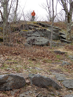
| Brian just had to climb to the top of this rock face to catch the view from the top. |
 |
| This cairn had a very distinctive shape. |
 |
| There were lots of interesting cairns littering some of the flat areas. |
 |
| We were treated to fabulous views of Mt Monadnock. It really sits out there all by itself. |
 |
| In this case, what goes down, must go back up again. |
 |
| We arrive at the Sharon Ledges, three quarters of a mile long providing a succession of outstanding views. We took an enjoyable 15 minute break here and let the baby out to stretch his legs. |
 |
| "Mmmm, Mommy. These sticks are delicious." |
 |
| Cassandra loves the water, so a little mountain stream was a great spot for a photo. |
 |
| We hiked right through Dominic's nap time. The walk ultimately tuckered him out. |
|
 |
| This was really cool. Another lost ski area: Flat Mountain (http://www.nelsap.org/nh/kidder.html). However, this rope tow is still in use. Brian talked to the owner who uses a jeep at the top of the hill to drive the rope. He even has his own small grooming machine and opens for people to ski when the weather permits. Not today, though. Bummer. |
We finished about 5 minutes after this last photo. This hike took 3:40 and was 7.1 miles long. As it turns out, there were quite a few hikers on this trail. We even saw Aaron and Troop 26, Ashby hiking. The scoutmaster recognized Alex from his Camp Wanocksett days. Small world.
I am very impressed with this trail. Mile-for-mile, the views are incredible for the amount of effort required.


