Saturday, November 21, 2015

North-South Trail - Hike #6

There weren't many interesting things to see on this hike, but at least I had some company.  Brian was finally able find a slot in his busy schedule and was feeling healthy enough to join me in this nearly 10+ mile segment.

The day was picture perfect, albeit a little chilly.  We were under a crystal clear blue sky the entire day and got started early for a change:  10:16am.  Check out the map carefully; you'll notice that the trail actually takes a jog into Connecticut.  Yes, Rhode Island is so small that they can't even fit in the entire North-South Trail.  

With trail guide in hand, we're ready to start down the trail.  Er, actually it's a road at this point.
At the end of Shippee Schoolhouse Road, there's a bell from the old schoolhouse - 1829-1918.
We cross US Route 44 and as we do, we cross into Connecticut.
This is Killingly Pond.  Along the road, there are multiple "No Parking" signs on the chain link fence guarding the pond.
We get another glimpse of the pond, at its far end.  I think it was just about here that we crossed back into Rhode Island, but with no signs on the trail, we weren't really sure.
Much of our hike today was spent on ATV trails - fairly wide with a lot of loose scree.
I'm standing near an old entrance to Oak Leaf Family Campground,
the  highest point on the North-South Trail, just over 800' above sea level. 
Several people have asked me, "Why are you walking uphill through Rhode Island?"
Yes, this tree is really dead and judging by the two big pink "X" markings, it should really come down.
About 1:15pm, we finally found a nice spot to take a lunch break.
Nothing extraordinary, but you can still see the azure sky reflected in the water.
Now this is what I call relaxing in the woods!
A few minutes later we were back at my car.  We covered 10.73 miles  in 4:10 (including breaks) for an average speed of 2.57 mph, but more impressive, we actually finished before 2:30pm.  Which is a good thing because you can see how long these shadows are.  The ATV trails were plentiful comprising about 65% of the path vs 32% gravel/dirt roads and only about 3% single-track hiking trail.  The only other "interesting" thing the guide book called out was how many different watersheds we traversed, which gives you an idea of how much up-and-down we were doing.  There's only one more town to go through and I anticipate two more hikes and I'll be done.

Saturday, November 7, 2015

North-South Trail - Hike #5

We were trying to come with a name for today's hike.  At one point the title "Non-Wildlife Hike" seemed appropriate. Another option might have been "Lotsa Roads".  In any event, with unusual November temperatures in the upper 50's, it appeared to be a great day for a hike.

Ahead of time, I knew that this was not going to be a particularly interesting hike.  I've been using Google "street view" to actually examine the hike route, so I was expecting a lot of roads.  I certainly found them.

Thanks so much to Alex for joining me today and helping with the car shuttle. The parking lot at our starting point, the Rice City Community Church, was busy this morning just like it was when Betsy picked me up two weeks ago.  Then it was a church supper; today it was a craft fair.

Beside this church, there are two historic schoolhouses; one from 1812 and one from 1846.
This Rhode Island historic cemetery occupied a prominent hilltop location. 
In total, we passed 4 cemeteries on this trip.
This is horse country in Rhode Island.  These guys were looking for company or a snack, but knew well enough to stay back from the electrified fence. 
Yeah, lots of roads, but at least there were plentiful bucolic vistas, too. 
The trail went right past the Foster Country Club.  These golfers were teeing off at the first hole.
This was actually noted in the trail guide. 
The sign on the telephone pole across from this entrance just said "D W N C -->";\.
That's an abbreviation for Dyer Woods Nudist Campground.   Peering down the driveway, I saw that the gate to the campground was actually open.  I guess even nudists need firewood.
This was a highlight.  In addition to the many horse farms we passed, there was also this alpaca farm.  These juveniles watched us for a while with curiosity, then wandered away.
This is definitely non-wildlife.   This truck/crane was loading lumber from a newly cleared field.
There's plenty of traffic along Danielson Pike, aka The Grand Army of the Republic Highway,
aka  US Route 6, probably the busiest highway on the entire trail.
Apparently, the Shady Acres Restaurant and Dairy Bar is another landmark along the trail.  After this point, we met up with a small group people doing some trail maintenance and improvements.  They made sure there were lots of "North-South Trail" signs north of this point. 
Finally, a trail rather than a road. 
I think this rooster also qualifies as "non-wildlife" as well.  Decolores!
Returning to Rice City, our car was only one left in the lot
It was an ambitious hike today:  11.83 miles in 3:44.  That's an average speed of 3.17 mph including breaks (the fastest I've recorded).  Our feet were quite tired at the end of the day as there was a lot of hard pavement.  We figured:  48% paved road, 45% dirt road, and only 7% wooded trail.  Now there are just over 20 miles to go to finish.  If the weather holds out, I might finish it before Christmas.  Join me if you can!

Sunday, October 25, 2015

North-South Trail - Hike #4

It's been too long since I've been out on the North-South Trail.  To be sure, it was a very busy summer and so far, a busy fall, too.  The thing is, before this hike, I still had completed less that half the mileage of the trail.  It's time to get going!

Being mid October in Rhode Island, one would think there would be a lot of fall color to see, but with overcast skies dominating all day, there wasn't a lot of vibrancy.  Betsy was busy in Providence in the afternoon, so it was providential that she could drive 30 minutes when she was done to pick me up.  I had no company today, but I enjoyed the extreme quiet along almost the entire route.

To start the day, I taught Orienteering to Boy Scouts from Troop 85 Weathersfield, CT at the annual Scout-O at Nobscot.  At 9:30am, it was still only 45 degrees, so a fleece was absolutely required.  From there, I drove straight down to the access road to Stepstone Falls where the last hike ended.  I did not drive down to the falls themselves, recalling from last time how terrible the rutted dirt road was.


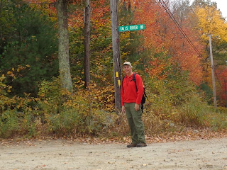
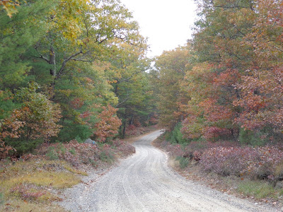
From the top of Falls River Road I'll hike down to Stepstone Falls. This is the road I wanted to spare my cars from.  The ruts and rocks get worse the further you go down the hill.

Here's the river just above the falls where Dominic was wading back in the spring.
I didn't realize at the time that I was hiking through an old ski area.  This was the parking lot
for Pinetop Ski Area back in the day.  Afterward, Betsy and I were both asking, "Where's the hill?"
Two small cemeteries across the street from each other. I visited the grave of one
"Rebecca , wife of Calvin Wilcox; died Aug 4 1862 in her 53 year.
These historic cemeteries can be found all over the Rhode Island countryside.

A ways down the road, I come across a managed conservation area.  The guide book reports this area as under the auspices of Audubon of Rhode Island.  While the sign shows the management evidently has changed, at least the area is still available for recreation.
Very colorful with nary a sound to be heard.
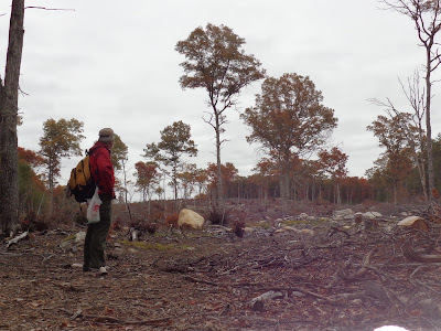
I'm standing 75' from the Connecticut border.  This logged out area goes back for a over 1/2 mile.
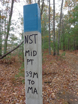
Now I'm officially halfway done with the North-South Trail as I'm passing by the cleared trees (back left).
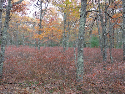
It was the ground cover (mostly blueberry bushes) aflame in this scene.
    
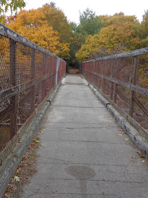
This was the most interesting feature of the hike.  This trestle is from an old railway line that was removed back in the 1960's.  
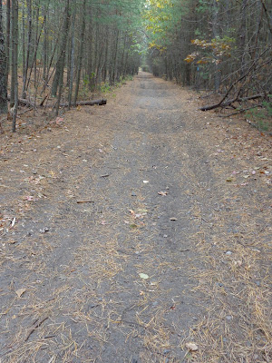
If you look carefully down the old rail bed,  you can see the undulations in the trail surface.  I'm not sure what caused these unless it's just bike or 4-wheeler use.
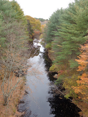
The trestle itself is at least 30' above the water below, affording a beautiful view down the Moosup River.

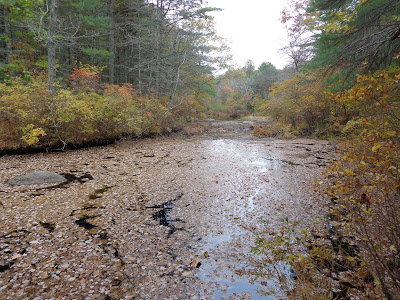
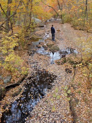
A little further on I find another leave-covered stream.

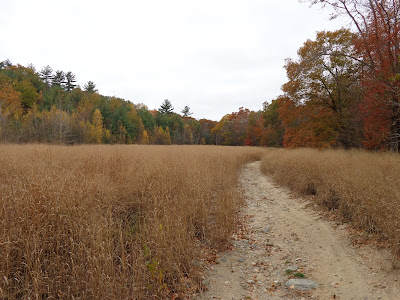
At last, I wide open field with some of brightest skies and most varied color of the day.

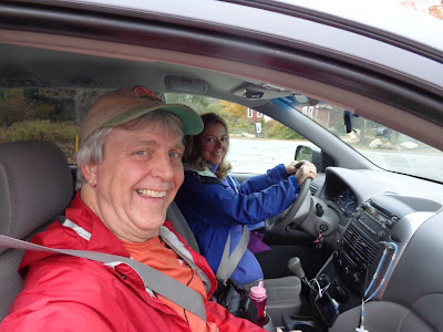
It was a long uphill walk to the my end point. Thanks, Betsy for picking me up.
I ended my day at the First Christian Church in the Rice City Historical District.  The Ladies Aid Society was having a church dinner.  Boy, did it smell good.  No wonder there was a line to get in.  Today's trail mileage was 10.28, but with the additional walk down to Stepstone Falls, the overall total was 10.90 in 3h50min.  Since I was by myself hiking on a lot of roads and I didn't want to be late for my pickup, I was moving at a pretty good clip.  Hopefully there'll be time and good weather to finish the rest this year.

Saturday, May 23, 2015

North-South Trail - Hike #3


"Three Day Weekend" - that's how I titled my invitation to my potential hiking partners prior to the Memorial Day holiday.  Yes, there will be ample time for family and yard work, but let's get a hike in first.  The forecast called for sunny weather, albeit slightly cool.  Perfect for a hike.

"Late, late, late" - that's what I said to myself as we started this hike.  Alex & I didn't start walking until 12:42 this particular Saturday, so considering we intended to cover almost 11 miles, it was going to be late afternoon until we finished.

What was nice, though, was getting more family time by having more of them join me.


At the start at Baker Pines Road.  Alex & I will start walking while everybody else will be heading for a nearby playground.  Dominic will be able to play Chutes and Ladders with Grammy, Uncle Nathaniel and Mama.  We actually had a false start.  About 1/10th of a mile down the trail I realized I dropped my guidebook so we had to head back for it.
Our first obstacle is Boulder Field, "an extensive area containing a seemingly endless number of boulders."  Formed by glacial outwash, there were several times I thought we were through it, but it just kept going.

Here's a glacial erratic.  Not as impressive as the Midstate landmarks Balance Rock and Sampson's Pebble, but pretty cool, just the same.

At Roaring Brook Pond, we cross an earthen dam (with boardwalk) while soaking in a marvelous mirror view.

Most of this part of the hike was unremarkable.  Alex & I were hiking very fast to make sure we would meet the rest of the gang on time.

At the break,, we had hiked 5.77 miles in just 2 hours, even with traversing the Boulder Field where the going was very slow.

     
Now, the rest of the hikers join us.  Nathaniel is out front with Betsy's trekking poles.       Alex, Cassandra, and Dominic followed.  Dominic likes to hike, but with his little legs, he has to take many more steps than we do.

This 4' high, 3' diameter precast concrete ring is actually a landmark in the hiking guide. What's it doing here so deep in the woods?

We meander along Roaring Brook.  In the distance you can see Betsy and others crossing the bridge.

We found a troll bridge here - Alex & Dominic under while Nathaniel crosses above.

Someone's obviously thought that the natural crack in the rock needed eyes and nose.

     
Rocks and water framed by the trees.       Betsy spotted this lady slipper beside the trail

We finally arrive at Stepstone Falls where we dropped our car over 4 hours earlier.

Dominic couldn't resist cooling his feet in the chilly water.
Mileage today was less than our my previous days at only 9.67 miles in 4:02 (plus .2 "stupid" miles for dropping my guidebook). However, it did include some hiking for everybody, chatting opportunities with some local fishermen and, best of all, precious family time.