Saturday, September 15, 2018

AMC Paddle - Squannacook Groton

A relaxed paddle close to home.  What a joy for a mid-September Saturday!

The Squannacook is a tributary of the Nashua, and information about paddling it can be found in the paddle guide from the Nashua River Watershed Association. I have paddled this river before, but it was way back in 2003.  It was April, and I was in the only boat I owned at the time, my 15'6" Cape Horn, which is actually a little too big to be paddling in this river, especially for a novice paddler.  Back then, we launched from West Townsend and during the course of the day I overturned into the river twice.  That was the day I decided I needed a smaller boat and better cold weather clothing (Geeez, that water was cold!).

Today we are launching from the West Groton Water Supply District, heading upstream to the rapids and back.
I'm paddling the Pungo today, along with 5 other kayaks and 1 canoe. 
The day is starting out a little cool and foggy, but the water is still pretty warm.
Right near the start, we see a great blue heron, who stands for a long time before flying off.
In this short stretch of river, we had quite a few blow-down's to navigate around.

Some were more difficult than others.  Fortunately, someone with a chain saw had been through here earlier.
Nonetheless, we still had to go through one at a time.
We reach our lunch spot near the rapids at around 11:15am.  It would be difficult coming the other direction.  There was not an easy path through.  Despite the recent rains, there were still many exposed rocks near the surface.

Walking up along the shoreline, I got a much better view of the rushing water.  The overall drop was probably about 3 feet.
The sun peeked out a bit on the way back.  Of course, we still had to maneuver under trees from time to time.

We got a little push from the current on the way back.
As I said, it was a leisurely paddle.  We covered 5.36 miles in about 3:19.  We were off the river by around 2pm.  Plenty to time to get to the 6th Annual Holy Family International Food Festival in this busy September.

Saturday, September 8, 2018

AMC Paddle - George's Island

The last time we attempted a trip to George's Island, we would up just looping Long Island, so I was anxious to join this trip.  Today I joined up with 6 other intrepid paddlers from the Boston AMC, several of whom I had paddled with in the past.  We had a newly certified leader who was anxious to demonstrate his navigational skills, taking into consideration the tides, winds, and forecasts.


We put in at City Point in South Boston, and we got started early because the parking in the area fills up fast.

First stop is Spectacle Island.  A very long concrete dock reaches out into the harbor.
The view to downtown Boston here is great.  It's about 4 miles to those tall buildings as the crow flies.


The visitor center is open and has restrooms.
Lunch stop on George's Island.  It's only 11:00, but we're hungry because we've been working hard.  We don jackets before snagging the plastic Adirondack chairs facing the harbor.
Ferry boats from Boston and Hull arrive and depart regularly.

I had to take a peek inside the fort before leaving.  It's a nice place to visit any time of year.
We head back down to the water to get back in the water around noon.


My phone ran out of power at the south end of Long Island, so I had to reconstruct the map for the last quarter of the trip.  While on the water, we changed plans to go around the north end of the island, and instead traveled down the east side to come around the southern tip.  The waves coming at us as we traveled southeast were 2-3" following waves that really pushed my boat around a bit.  It was quite a workout.

From there we passed by the old Long Island Bridge abutments and headed toward the Dorchester Gas Tanks coming around the south end of Thompson Island.  We had to pass through a standing wave that extends from the south tip of the Island down to Quincy.  Then we turned north to head back to City Point, passing the JFK library.  Ultimately, we paddled 13.04 miles.  We were on the water by 8:35am and were back at our starting point around 2:25pm.  With only an our for lunch and exploring the island, that means we were paddling for a long time.  All things considered, one of our leaders said this was a solid Level 3 paddle adventure.  I'll be due for a soak in the hot tub later.

On the way back to City Point, we could see the Anthem of the Seas (RCCL) rising about the Black Falcon terminal.  Boston is the first stop on an 11 night cruise out of Cape Liberty (Bayonne, NJ).


Saturday, July 28, 2018

AMC Paddle - Potter's Cove past Gould Island

Just one week later and I'm here's another part of  Narragansett Bay I've never paddled.  This one starts in Jamestown, the largest island in the bay, directly across the channel from Newport, home to the Newport mansions, summer "cottages" of the extremely wealthy of the late 19th and early 20th century.  To get to the put-in, I will actually have to take the Jamestown Verrazanno Bridge to Conanicut Island (Jamestown), making sure to get off at the last exit before the toll on the Newport Bridge.  Surprisingly, it was just three of us paddling again this weekend:  Mike, Mike, and me.

As it turns out, the world famous Newport Folk Festival was also going on this weekend, and we could discern occasional drum and bass sounds coming across the water.

Our first destination was Gould Island, a former WWII  torpedo testing facility in the middle of the bay.
From a distance, the area to the right of the smokestack looked like a hill, but it is actually the remains of a very large building.
At the south end is a marker for the "airport" part of the island.  Sea planes would land here and pull into a former hanger.
We landed our kayaks and explored a little of the island.
From the large concrete lot,one has a great view of the suspension bridge into Newport.


There were remains of old buildings, but we found evidence that there had been some clean up or other activity here recently.

Out a long pier from the other buildings was the torpedo firing facility. 

From this angle, you can see the two torpedo recovery bays.  The launchers were on the flat side of the building between the towers.

This building is the old North Light House at the northern tip of Jamestown Island.  You can see above the square building how it formerly would have had a light housing.
We looked a while for a lunch spot after around the north tip of the island, but eventually made our way back to land at this public beach on the east side.  The rocks and waves were much smaller and easier on the boats.


The Newport Bridge is very impressive, but it took us forever to paddle down to it.  It seemed like it was closer than it actually was, I guess.  In any event, when we got there, we went a little further to circle around one of the pylons so we could say we paddled under it.
The three of us kept a steady but reasonable pace, so we covered 12.25 miles in a little over 5 hours
including 40 minutes for lunch.  The sun peeked in and out a little during the day, but there was a light haze in the air all day.  For this reason, it was great to be on the cooling waters of the bay.

Saturday, July 21, 2018

AMC Paddle - Spink Neck Beach to Prudence Island

When a paddling activity is posted to someplace I haven't been before, I generally jump at the chance to go.  Such was the case with this trip.  When I arrived, I expected to see many of the usual paddlers, but today it was just the leader, co-leader, and me. 

Once again in the Narragansett Bay, our plan was to swing by Hope Island and then head over to Prudence Island.  Weather conditions, of course, would dictate the actual route.  The weather today was bright and sunny with a bit of a breeze.  Unlike the last several excursions, this trip started north of Quonset Naval Air Station.  But to get there, I still passed by the expansive car unloading facility where one could view acres and acres of new automobiles freshly arrived from overseas. 

We departed on time, just after 10am.
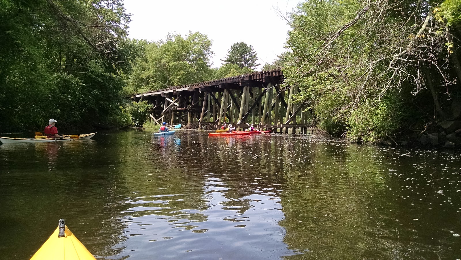
This is our whole group today.  This paddle would take us over large expanses of open water.
Hope Island is covered primarily in poison ivy.  Nearby are a couple of tidal rock islands like this one frequented by sea gulls and cormorants.
Making it to our lunch stop on Prudence Island, we find serpentine inlets and salt marshes.  The landscape was very similar to bay side on Cape Cod.

There is a year round population on Prudence Island, but the only way on or off the island is by boat.  A ferry runs from the other side of the island to Bristol, RI.

There was no place to sit for lunch, but the beach was easy for us to land and launch from.

The skies were still bright but wind picked up after lunch.  I wanted to take a picture of the 12"-18" waves we were going through, but honestly, I didn't want to take my hands off my paddle as I needed to stay focused.

We finished up around 2:30pm after paddling 10.7 miles.  I found that with the crosswind and following waves, I had to drop my skeg for most of the crossing back across the bay just to keep going straight. A little challenging, but a great adventure nonetheless.

Saturday, June 30, 2018

AMC Paddle - Wickford to Rome Point 2018

This is my third time doing this paddle adventure on Narragansett Bay, but honestly, it never gets old (compare 2017 and 2016 - each a little different).

It was a perfect day to be out on the water.   I missed my turn and took a little detour through Wickford village and found a paddling store that I didn't have time to visit.

As for the actual paddling, we put in just after 10:00,  our target departure time.  Today we had 3 Bills, 2 Mikes, an Ann and a Steve.

We have to paddle quite a ways through all the marinas.  This stately residence site just at the harbor entrance.
The channel marker is also an elaborate osprey nest.  Compared to last year's picture we had beautiful blue skies as you can see.

Our next objective is Fox island.  It is supposedly under private ownership but seemingly not the "dentist"
(see  https://www.reddit.com/r/RBI/comments/42e24l/who_owns_fox_island/).

As we approach Plum Beach Lighthouse, you can see how choppy the water is getting.  Our leader was trying to line us all up for a photo, but we kept getting swept into the rocks on the island.  Next time.


From the lighthouse we head to shore paralleling the Jamestown Bridge.  Unfortunately, between the wind and the tide, we were actually being swept southward almost into the bridge.  It took some concerted effort to break away toward the shoreline.

Heading back north, we pass these pontoons which are part of the Rome Point Oyster Farm.
Time for a lunch stop along the north facing beach on Rome Point.


We watched some young ladies trying their skills on stand-up paddle boards.

There is wildlife on this trip.  I was able to get close enough to get a good shot of this snowy egret.

I never seen this before.  This sail boat apparently didn't fare well in a recent storm.  It looked like most of the electronics were removed, but it left us wondering on what will be done with this half submerged vessel.

We made it back to the put-in before 2:30, my drop dead time to get home to help at Betsy's performance of Don Giovanni with Greater Worcester Opera.  We covered 10.5 miles in a total time of 4:18 including lunch.

Saturday, June 9, 2018

AMC Paddle - Charles River Medfield to South Natick

I've only paddled a couple sections of the Charles River:  the section near the boathouse in Newton and in Cambridge out to the Boston Inner Harbor (both years before this blog started).  In any event, I was up to try this section in South Natick.  To be honest, I always think of the Charles as running west to east and never considered that it sometimes runs south to north.

I was with AMC Worcester today and we had a small group  of 7 paddlers in total.  For the most part, the river was wide and slow moving, so the paddling was easy.  Nonetheless, there was actually quite a lot to see along the way.

This was another shuttle trip which means having to find places to park cars near the take-out just before the dam in South Natick, which was hard with all the activity at the nearby baseball fields.  But we finally got started on the river at 11:10am.


This wooden train trestle cuts through a corner of the Medfield Charles River State Reservation (park).   In the extreme foreground, you can see I am paddling my yellow Pungo 120, which I usually paddle on these inland rivers. 

There were many sections of the river that looked like this: peaceful, wide open river with low vegetation.

On these river trips, we often wind up chasing great blue herons down the river.  This one took a break and stood still long enough for a good picture.
At our lunch stop, we were treated to some retrieval training for dogs.  Apparently, dogs and owners were being trained.  The man in charge would throw a duck decoy out into the water, then give a signal to the dog to go retrieve.  The dogs were even able to retrieve "blind", that is without seeing where the decoy was thrown.  Very cool.


The dog waits patiently at the river's edge while the man at left prepares to throw the decoy into the water.
On signal, our dog splashes into the water to retrieve the decoy.
He swims out to the decoy...
... then brings it back to the trainer...

... and drops it at his feet.

    
Then, they run through this scenario... ... a few more times.

After a nice lunch, we started down the river once more.

This river landing is located in Rocky Narrows Reservation.  There are both hiking and equestrian trails available here.  Some of the horses and riders are taking a break here. .

From this stately house, one can view the river
through a long gauntlet of trees.
Our Lady of the Charles
This large statue of the Virgin Mary
was placed here by local
 poet and professor in 1929.

Just a little past the statue was this footbridge, known at the Sargent footbridge.
"This private footbridge was built by Daniel Sargent after he bought the house on river left and an adjoining parcel of land on river right in 1921." (Charles River Guide)
Along the way, we also passed Peters Reservation.  I'd love to come back to this area and explore these various reservations for hiking.

We ended our adventure just after 3:00.  In 3 hours 55 minutes we traveled 9.13 miles averaging a lazy 2.33 mph.  The sunny weather held for day and look forward to another one soon.