Augh, Spring! Mud season - yuk. Since ski season's over (boo-hoo), I have to do
something to get outside. And I would rather it
not be yard work. So with no pressing engagements, I decided to extend last year's hiking adventure with the shorter (albeit hillier) Wapack Trail. The Wapack picks up near the northern terminus of the Midstate at Rt 119 in Ashburnham (see last year's Hike 1A).
Today, however, in order to save a little time, Brian and I started hiking at West Binney Hill Road. FYI, this is a
dirt road, and in pretty bad shape from the tough winter. Lots of little potholes and a little rough on my 10yr-232K Outback. Be that as it may, we left a car across the street from Windblown XC Ski Area, shuttled to our starting point and started hiking at 12:32pm.
 | |
| Brian and I are ready to start at the mini-lot across the street from the ski area. |
|
|
|
|
 |
| The scenery on this section of the trail was quite varied. | |
 |
| No blue sky but grand vistas and comfortable temperatures. |
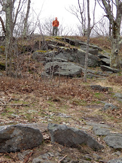 |
| Brian is up at the shoulder (false summit) of Mt. New Ipswich. On this section of trail we had to travel over 4 small mountains. Nonetheless, they were still uphill. |
 |
| A fine view of Mt. Mt. Monadnock in the distance. |
 |
| At one of the summits, there was this relatively new dedication plaque. |
 |
| We arrive at the boundary of Windblown XC ski area. The trail travels the perimeter to avoid damaging the winter trails. |
 |
| Late April, but still some snow left on this trail. |
 |
| An XC trail sign and the Wapack sign share this tree. |
 |
| The tree across the brook creates a natural reservoir and waterfall. | |
|
Our hiking time was 2:42, so Brian could make his next commitment. We estimate the mileage to be about 5.8 miles, but the amount of elevation is unknown. Let's just say that four small mountains definitely counts for something.


No comments:
Post a Comment