Monday, July 16, 2012

Hike 8 - Section #7 & #8


One my my goals in this cross-state hike is to include as many of my friends and family as possible, so they can all be part of this experience.   My son, Matt, was up this weekend for the baby's baptism, so it was an opportunity to include him in the hike, too.

The next scheduled section was a 4 mile stint.  "Too short," Matt said.  So we opted to do the next two sections.  This hike was unremarkable in most respects.  The first section traveled mostly along both paved and unpaved roads.  The second section wound through some towering hemlock forests and dense ferns.  Both sections were pretty buggy and, despite the cloudy start, it was hot and humid.  One note of interest, however, was the fact that we hiked through  parts of 4 different towns:  Princeton, Rutland, Hubbardston, and Barre.

We start next to a big patch of roadside poison ivy.  Yuk!
After being on road for a while, we finally enter a wilderness area.
Down Rt 68, you can see the ice cream shop where Mr. O likes to stop halfway through the merit badge 20-miler.
Finally, off road beside a rocky brook.
It is mid-summer, so the vegetation is exceedingly thick.  There were some newly built bridges, too.
This was interesting.  An erratic covered in moss.
The wild blueberries were ripe and delicious.
The trail veered into a clearing and we were hiking in ferns that were up to our waists.
They have frisbee golf at the Barre Falls Dam.  It is an Army Corps of Engineer's flood control project, a so-called "dry bed resevior" because it becomes active only in extremely heavy rainstorms, like the hurricane of '38 (see Barre Falls Dam).
Tiger lilies are seen along many roadways in the summertime.
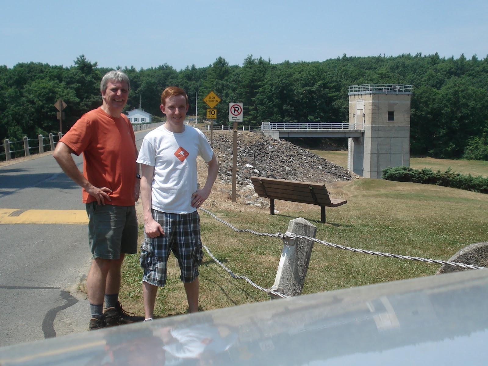
Completing our hike, the dam is in the background.

Today's hike was 8.66 miles in 3:04.  The sun came out and it was really hot when we finished.

Wednesday, July 4, 2012

Hike 7 - Section #6

It's Independence Day and I have the day off, so what better way to start it than by heading out for a little morning hike.  At home, we've been a little distracted for a couple days, as my daughter-in-law's pregnancy ended in the birth of her first-born son, this past Monday evening.  Amidst this happy news (and along with some sleep deprivation for everybody), a little peaceful time in the woods sounds like a refreshing change of pace.

It was raining when I woke up, but the radar showed that the showers would be past us soon.  I joined my hiking partner, Jim, at our usual Dunkin' Donuts in Sterling and we set off.  As I was putting my boots on at our step-off point, the rain starting coming down it buckets.  It held us up for 5 minutes before we thought it safe to venture out.  Today's hike is extremely familiar:  beginning in the Wachusett Mountain Ski Area parking lot, head up and over Mt. Wachusett ending up just west of Princeton center.

The new grandson, Dominic Joseph.  Born July 2, 2012 11:24pm.  7 lbs, 7 oz, 21 inches.
Steve & Jim at the beginning of the Balance Rock trail.  The rain stopped, but it's still a bit wet.
Jim is re-adjusting Balance Rock to straighten it out a bit.
Holding on at the top of the Polar Express ski lift.  Yes, I admin it - I just can't wait for ski season!
From the top:  No view of Boston today.  Geez, we can barely see the fire tower.
This is an eft or a  juvenile eastern newt.  Alex tells me he is an amphibian so he has no scales.  Picking him up is a bad idea, because the oils in your hands are not good for them.  These bright orange guys were all along the soggy trail.
Besides being on the trails, they were also all over this tree trunk.
This is kind of strange.  This body of water was bordered by a stone wall on the right and the one we are standing on.
The trail passes through the Wachusett Meadow Wildlife Sanctuary (Mass Audubon).   They mowed the grass so we could make it across the meadow more easily.
Back at Jim's car on Rt 62.  By now the sun is shining brightly.  I bet it's beautiful back at the top.


Today we hiked 6.21 miles in 2:35 with 1000' of vertical (Wachusett Mountain).

Saturday, June 16, 2012

Hike 6 - Section #16


It has been so crazy the past few weeks with  activities:  the graduation party, the opera, the baby shower, the opera, Franciscan meetings, graduation parties, the opera.  You get the idea.  But now it's Father's Day weekend.  Armed with that fact, I am able to talk Betsy and Nathaniel into joining me on a family hike this beautiful Saturday.  Although, to make it more interesting for them, I set aside my OCD tendencies and agree to do a section of the hike out of order, stipulating, of course, that we still continue to travel north-to-south.  We choose a stretch in the south part of the county (see map).

Driving down to where the trail crosses Rt 16 in Douglas, we drop Nathaniel's  car, then head back to the Baptist church in West Sutton to begin hiking.  From here, the trail follows Douglas Road, past the sweeping fields and pastures of Whittier Farm.  Then, just before we enter the woods, a young man a truck recognizes me and with excitement, pulls over.  It Andrew H, who used to be a member of Troop 11, years ago.  He's older now, having just graduated from high school.  I haven't seen him in years.  He's from Sterling, so what are the odds I'd meet up with him way down there?

Having a long stride, Nathaniel stays ahead of us most of the hike.  We do our best to keep up.  The sky is clear blue and the temperature is about 70 - warmer in the sun and not too buggy in the shade.

Traditional "beginning" photo; church in background.
Beside the road, this little pond was covered with lily pads.
A quick stop at the Whittier Farm road stand, where we pose for tourist photos with the "cows".
This is a real cow, but I didn't get her name.
We stop next to a pond, one of the few views along this section of trail.
Nathaniel dared me to pose on the rock, but straddling the water was the best I could manage.

A nice wide section of the trail - tall trees and Nathaniel out in front.

A stone bridge over a babbling brook is a good place to stop for a snack break.
I think this tree with the trail marker is supposed to be standing upright.

Near the end there are some well constructed boardwalks over boggy sections.
We pick up our car. The rock where I set the camera was a little crooked, but it's the only way I can appear taller than Nathaniel.

Today's mileage is 6.06 miles covered in 2:32.  It was nice to have family along.

Monday, May 28, 2012

Hike 5 - Section #5

Memorial Day, 2012.  You would think I would have had time to hike some other day this weekend, but it's one of those crazy weekends again:  Confirmation and Pentecost on Saturday, a graduation party for Nathaniel on Sunday, and a parade this morning.  Whew!

Some stretches of today's hike are very familiar, as they are close to home and I have done them many times.  Being a holiday, most everyone else is busy, so I start hiking solo.  Going past Crow Hills Pond in Leominster State Forest, I can hear people playing at the beach below and I actually pass some other people hiking in the park.  Then James calls and is interested in joining me for a while. Yay!  The walk starts out buggy - lots or gnats and few mosquitoes.  It's the hottest hiking day yet and somewhat humid, too.  We also have to deal with ticks.  The last 200 yards of the hike goes through a tall grass field infested with them.  Between James and me, we brush 9 ticks off ourselves just in that short distance.

Starting point on Narrows Road .
Up, up, up.  Part way up the  "Stone Staircase" built by the CCC back in the 30's.
From the top, you get a great view of the Fitchburg landfill.  Really, it's beautiful.
I'm not sure what these are, but they were trail-side in both white and pink.
The rock climbing area at Crow Hills. You can see someone belaying at the bottom.
James joins me at Redemption Rock.  Learn all about the rock and Mary Rowlandson here.
We had to ask the geese and goslings to move into the pond in front of the Mt Wachusett ski lodge.
Thanks to Alex for picking us up at the far end of the ski area parking lot.

Today's hike was 4.77 miles in 2:20. 

Sunday, May 6, 2012

Hike 4 - Section #4

Alex thought that this would be a rather uneventful section of the trail - at least according to the MidState Trail Guide, in which several sections were shown to be on roadways.  As it turns out, however, the trail has been re-routed in several places, reducing the "road" experience significantly.  We started to suspect this by noticing that some of the trail sections and landmarks did  not match up to what we were reading in the guide (4th edition, 2002).  We also noticed that these sections seemed to be less worn and that the marker paint and signage (those ever-present yellow triangles) appeared much newer.  After I'm finished with my "thru" hike this season, I think it will be time for me to buy an updated trail guide (see www.midstatetrail.org).


Alex & I are about to start our hike at the Graffiti bridge where we lift off last week.

Lots of beautiful stone walls winding through the forest.

We found some wide open spaces we weren't expecting.

Look!  Cows!

The trail actually goes over this stone wall.
These are more cows.  What you can't see is that they're actually stampeding towards us.  No kidding!  They were heading for the cows seen in a previous photo, who also started running toward them.  The trail we were hiking was in between these two groups of stampeding cows (yikes!), but thankfully guarded by wire fencing and a stone wall.

This is an old gravel pit that we saw on the map, now grassland.

This is one of those brand new trail markers I mentioned at the beginning.  Even the nails are brand new.

The trail crosses Rt 2 here.  Alex is ahead of me as usual.

Did I mention I love photos of babbling brooks?  This water was really moving.

Ending the day at the babbling brook is even better (see car through the trees).
Today's tally (trail re-routings notwithstanding) was 4.91 miles in 1:42.  I am up to milepost 18.41.  Only 74 miles to go!