Saturday, July 30, 2022

Honey Paddle - Mystic River

 It is a beautiful day!  It's midsummer and a perfect time for paddling somewhere.  There is not AMC paddling adventure today, so we have some alternatives.  Betsy has the day off and so maybe we an go out together and have paddle adventure.  We talk about going to Mystic, which is always a good destination.  I've paddled the Mystic River a couple of times with Barry and the Connecticut AMC, so I am well prepared to take Betsy out.

 The best put-in spot is on the river road just to the north of the I-95 bridge.  

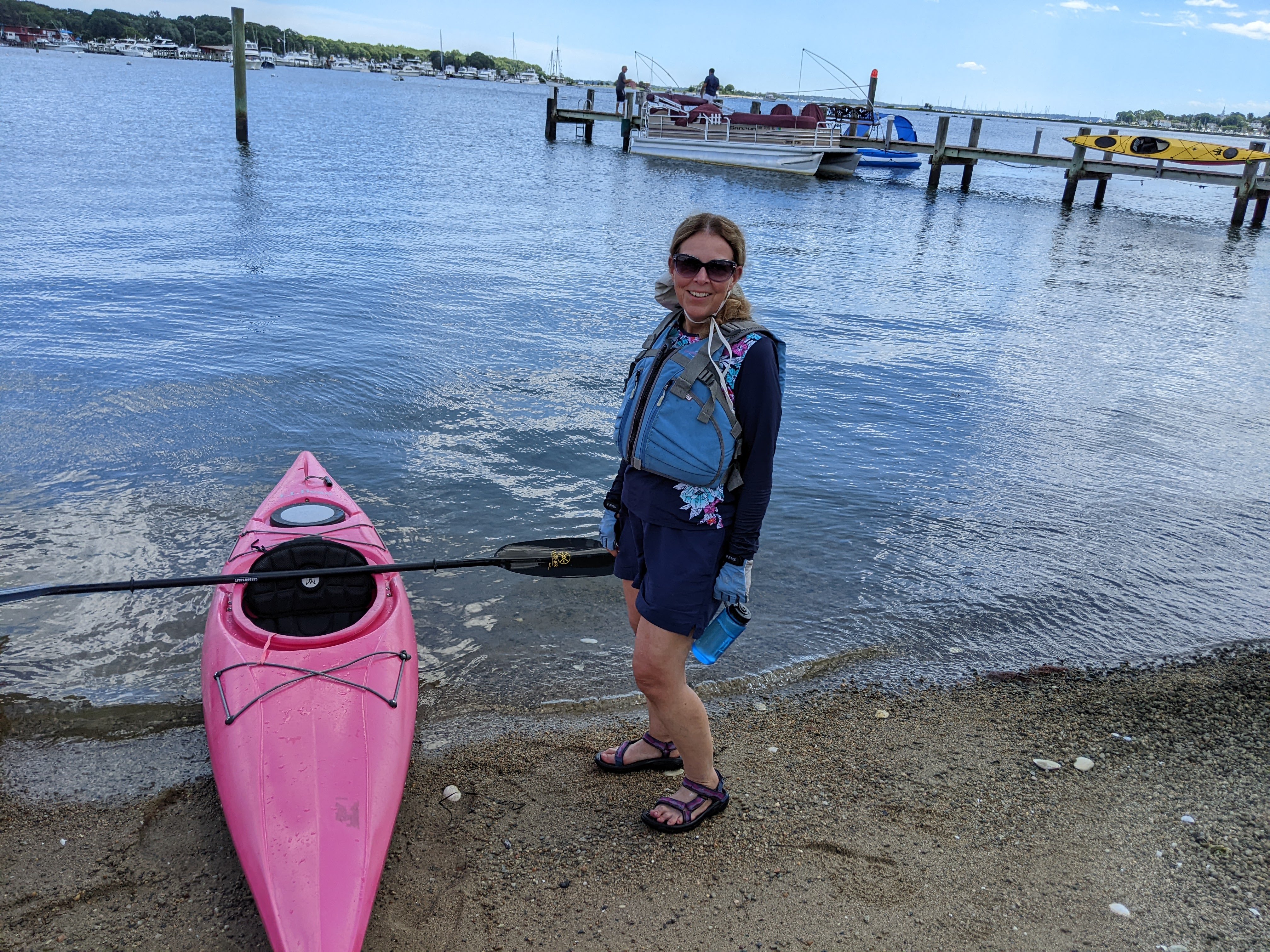
This was the first time the "pink boat" has been out all season.  
There's plenty of parking and the put-in at the river's edge is sandy, not muddy.

I think this is the one of many buildings of Mystic Seaport Museum. I think.
We paddled right up alongside the flagship of the museum, Charles W. Morgan.

We paddle through downtown Mystic, under the Rt. 1 bridge and past the marinas.
We need a break so we find a building that has a commercial look to it, but just in case, we pull to the far end of the private beach, so as not to intrude.

It turns out the "commercial" looking building was a private residence.  But the owners were wonderful people.  They offered us water and bathroom break and we chatted with them for a good 20 minutes.


We head back up river.  This cormorant is drying out on top of this pier piling.

The weather stayed great all day and we covered 5.44 miles.  Next up, we'll be looking for seafood dinner stop (where we won't have 60-90 minute wait for a table).  Great fun! 

Saturday, July 9, 2022

Meetup Paddle - Quinebaug River Trail upstream from East Brimfield Lake

 kjhlkjh

j;lj;l
;lkkj;lkj
;lkj;lkj


  • 8.69mi
    Distance
  •  
  • 2:55:23
    Moving Time
  •  
  • 0ft
    Elevation
AvgMax
Speed3.0mi/h14.2mi/h
Elapsed Time4:49:28

Saturday, June 11, 2022

RICKA Paddle - Wilson Park to Fox Island

It is a beautiful day for a paddling adventure.  There are not a lot of outings listed on the AMC website for the Narragansett Chapter these days, many of them also paddle with The Rhode Island Canoe and Kayak Association (RICKA).  Either way, this is a really great bunch or people to paddle with.

This outing is similar to one I did from Wickford to Rome Point back in June of 2018, however this excursion is a little shorter.  Every time you go out it's different:  the weather, the water, the people.  It's all fun.  Compared to that trip, we did a little more exploring off to the sides.  Nonetheless, some of the pictures will actually look quite similar to the earlier ones.


This residence is impressive every time we go by it.

On this trip we're actually doing it a little backward from my previous trip.  We round Poplar Point and then head toward the North Kingstown town beach.  These people have nice waterfront property just around the Point.

After a lunch break, we head to Fox Island, a private island in the Bay.

Behind the house is a big weather vane, probably part of a weather station.

The skies are clouding up a bit, but it doesn't seem to bother this extended family of ducks.

Before our take-out, we take a little extra time to explore Mill Cove, just to the north.
Lots of wildlife here including this pair of white egrets.

Out total distance was 7:64 miles covered in 2:16.  However, it may actually have been a little longer because my phone tracking took a little vacation after Fox Island due to snapping a photo.  Our entire time out was 3:51 which means we enjoyed a very leisurely lunch.

Thursday, June 2, 2022

AMC Bike - Alewife Loop


Now for something completely different!

I'm always up for trying something new.  This was billed as a 17 mile ride from Alewife in Cambridge to Woburn.  At first, this seems like a pretty tall order, but what's funny is you don't realize how these towns fit together like a jigsaw puzzle.  Furthermore, a ride starting from Alewife Station is actually within reachable from Leominster;  it's just straight shot down Route 2.

Now, where to park?  It turns out there's a DCR parking lot right near the apartments just before the "T" station.  Hey!  Free parking.

Oh, cool!  We're travelling down the Mystic River Parkway and right past this beach.

This is just one of the really nice looking homes in Winchester.  The property was not huge, but it was nicely manicured.  Who can afford to live here?

If I look a little pained here, it's because we're stopping for yet another stop light. 
Riding in the city is not picnic. Not a lot of hills, but plenty of traffic.

This is "downtown" Winchester where the town offices, etc are located.
Even the buildings here are beautiful.

We're not lost, but we are getting a little more spread out.  This was a left turn around a traffic rotary.  
We regrouped on the other side.

We kind of lost our way a little when we got into the edge of Woburn, but we recovered and made it back in good time, travelling 15.33 miles in 1:31.  The elevation gain was only 465'.  The most challenging part of this ride was city traffic.  I guess I'm spoiled out here in the country.


Saturday, April 9, 2022

AMC Paddle - Assabett & Concord

On the one hand, ski season has ended.  I got to ski for 2 1/4 hours on Tuesday, March 29, so while I didn't make it to April, my ski season did last just over 4 months.

On the other hand, paddling season has begun.  I always start my season on the rivers.  Even so, a wet suit is required, just in case I take an unexpected spill into the water.  

The forecast calls for scattered showers, but often the weather gets better, so I'm not worried.

Our intrepid flotilla consists of 7 kayaks, 6 canoes, and 17 people.  We start our voyage in West Concord on the Assabett River.  The river winds a while before joining the Sudbury and becoming the Concord River.

The current is moving at a pretty good clip.  That's one of the fun things about paddling in Spring.

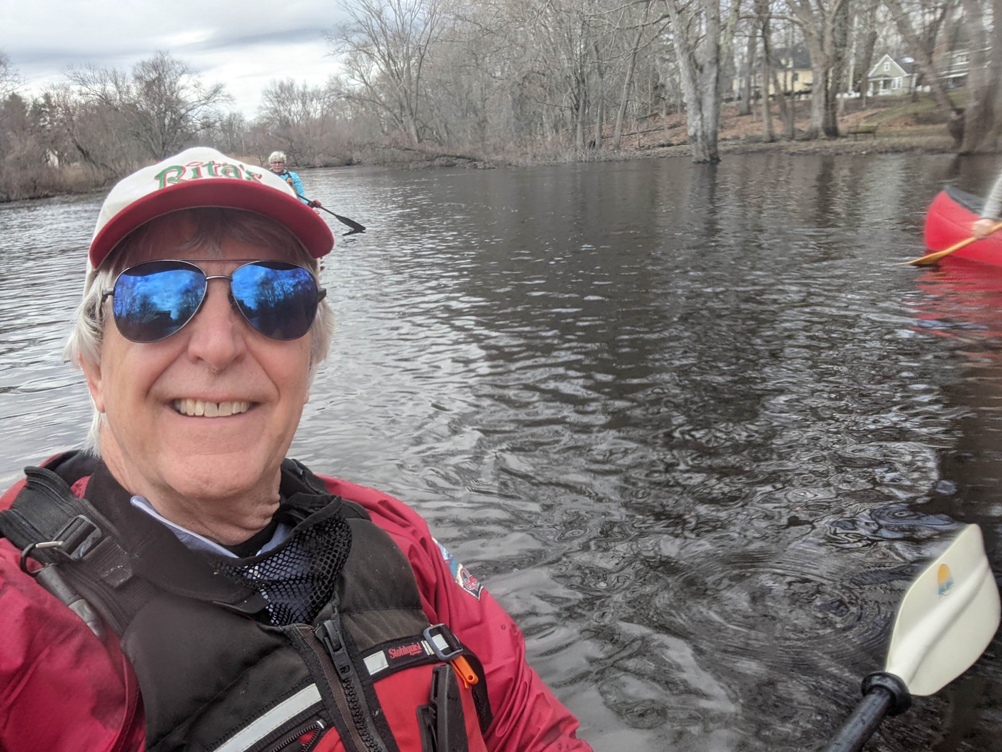
Just to prove to you that yes, I am on the river.

Time for a little regrouping before skirting around some low hanging branches.

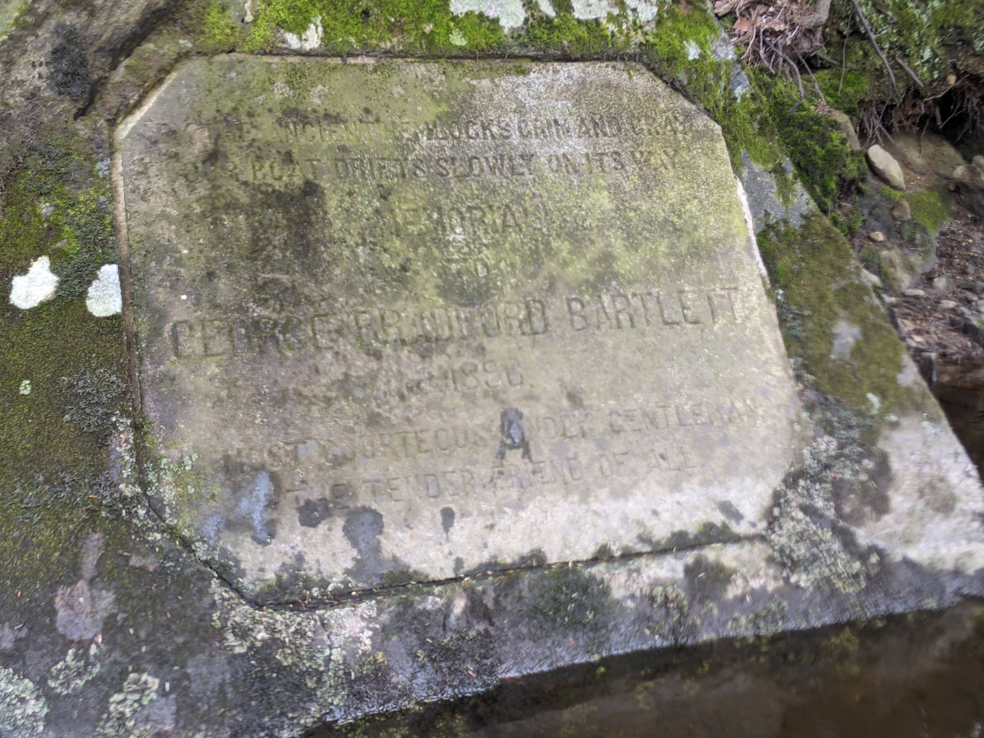
This engraved stone was at the water's edge.  I really can't tell you what it says because even in person it was pretty hard to read.  However, the name at the bottom is somebody named Bartlett.

This is where the Concord River begins.  From my vantage point, the Sudbury River is to the left and the Assabett (where we came from) is straight ahead. 

Our lunch stop is at the North Bridge in Concord, where the British & and the colonial minutemen clashed 247 years ago.  Look closely at the surface of the water and you can see it pouring. 

The rain stopped for while, but these are not "happy clouds".  
I took this picture right before the thunder started skies opened with hail.

The camera case is a bit foggy and wet.  As for me, I'm looking a bit like a drowned rat, so I take a quick respite under the Rt 225 bridge just before our take out in Bedford.  Yes, it's still raining.

Everybody made it back, but we were a bit spread out by the end.  My total time on the excursion was 3h24m, covering 8.32 miles.  My average speed was 3.6mph, but paddling hard with the current, I got all the way up to 9.3mph.  Next time, I'd love to avoid the rain.


Monday, February 21, 2022

Copicut Woods

It's Presidents Day weekend, the busiest ski weekend of the entire season.  My season ski passes are not good anywhere today, but it's a day off from work and I don't want to waste it sitting at home.

Oddly enough, we just came through a rainy spell and much of our snow is gone for now.  I'm thinking perhaps it's time to get our for a winter hike at another Trustees property in the state.  

I head south to Copicut Woods just outside Fall River.  About 1h30m to get there.


Winter can tough on some of these trails.  Note the felled trees that now cross the paths.  Other areas appear to be ready for some spring maintenance when that season arrives.  You can also see the long shadows projected by the winter sun, even in mid-day.

More rock walls on this property.  Most likely, there were "roadside" walls back in the day.


I'm not sure which of these signs is worse.  In any event, it means trouble for hikers like me.

This little brook ran underneath the tail (see below).  Despite being winter, there's lots of water moving.


The trails got very confusing when it got to the road.  There were lots of cars parked here at the Conservation Area, where hikers were coming from multiple directions.  The conservation area plaque was on a hillside for an earthen dam.

Here's the view from the top of the dam.  It turns out this is the Copicut Reservoir.

There were a *lot* of hikers out today.  It was an annual hike, but I didn't catch the name of the organization.  At one point I must have passed about 60 hikers going the other direction.


Nice place for lunch break.  As you can see, the sunglasses come off because despite the blue sky, there are a lot of shadows in the woods.


Well, it looks like this might have been an even better place to have lunch.  Oh well.

Although I didn't find any snow, there were ponds in the woods that were still frozen.

Today's hike covered 5.26 miles in 1h46m.  The elevation gain was negligible:  only 172'.  Nonetheless, it was a great way to spend a real day off from work.


Tuesday, January 11, 2022

New Jersey Pine Barrens

This "easy" hike on a very, very cold day was taken during our substitute vacation (we were supposed to be in Colorado but with the Covid labor shortages and flight cancellations we were afraid we wouldn't make it back in time for Betsy to teach her January class).  In any event, we wound up at a Marriott property outside Atlantic City.  After exploring several towns at "the shore", today we opted for a nature hike for a change of pace.

We visit Jakes Branch County Park.  This tip came from our son Matt who relayed that this park had a great nature center.  We decided to check it out for him and we discovered even more.  The property was just off the Garden State Parkway in Ocean County, New Jersey.

We're here!  There's less snow on the ground than the other day, but it is COLD!

The visitor's center looked very cool with an observation tower high above.


Exhibits inside were first rate and included examples of wildlife to be found.

Getting to the observation deck required an easy climb of a couple flights of stairs.

We gazed across the Pine Barrens out toward Lakehurst Naval Air Station
(where the Hindenburg exploded in 1937).

The parking lot views are a little less exciting.

The panoramic view from the top shows that the Pine Barrens are very flat - no mountains or hills.

We hit the trail.  There are some obstacle-course-like activities that the kids would absolutely love!


The sandy trails littered with pine needle are easy on the feet.

From time to time, intentional fire breaks can be seen crossing the trails.


After we did an outer loop, we explored the interpretive nature trail (check out the map above to see both loops).  There were numbered concrete posts describing vegetation and other interesting elements.  There was also a paper guide, but unfortunately, I forgot to pick it up back in the building.  Instead I took pictures of all 10 posts.  These are the first two, but I will spare you for all of them in this blog.

There was not a lot a wildlife to see on this very cold day.  This bird of prey perch up high may have been part of the reason.  I'm sure he was looking for his next meal.
I can't remember what #4 was (I have since misplaced the guide to the nature trail).

Our winter adventure in the woods covered 3.01 miles in 1:18.  From there we hopped in the car and set off for the beach.

You thought I was kidding, didn't you.  
The only downside besides the wind.... I forgot my book.