Monday, February 15, 2021

Two-Fer - Quinebaug Woods & Tantiusquis

It's another winter holiday, which means I can't (and won't) go the mountain to ski, but I will not stay couped-up either.  Time to knock some more Trustees properties off the list.

It is a gray day, but the temps are right around freezing and it is raining intermittently.  I still want to avoid people if possible, but I will turn south to see what I can find.

I start by vising Quinebaug Woods in Holland, MA.  On the way there, I pass some parts of the Quinebaug river where I have paddled in the past (see April 21, 2019)


As I'm walking down the trail, I see this bright purple.  It's too early to be flowers, for sure 
It turns out to be some garland, clearly added to make this a trail-side Christmas Tree.

The trail is wide and accommodates not only hikers, but evidently cross-country skiers as well,


The trail winds down to a river.  I'm thinking this actually is the Quinebaug River.  Seeing it now, it's obvious why we only paddle it in the spring.

I got back to my car and realized I had missed one of the landmarks of this property.  The remnants of an old chimney on the hilltop.  The house that was previously here must have had quite a view.

On the map, you can see how I went back out to see the chimney, then came back an alternate way.  Total mileage was only 1.25 miles gaining a total of 238 feet of elevation.  This was not nearly as exhausting as my outing a couple weeks ago in 13°F weather.


My second stop today was at Tantiuques, which is either pronounced "tan-te-us-quays" (per the book) or "tant-E-ooo-kwiss" (per the sign on property).  In the Nipmuc language, it means “to a black deposit between two hills”.  It was the site of one of New England’s first mines.  A lead mine, as it happens.  


In any event, using Google to navigate here from Quinebaug Woods was difficult at best.  Taking the "shortest" way, it should only have been a 4 minute ride; however, the map software didn't take into account local road closures.  Or worse, dirt/private roads.  I had to go back into Sturbridge and get onto I-84 down to Exit 1.  It was easy after that.


Just off the trail, one can see where some of the mining happened amid these large rock faces.

This is my "Yes, it's me" photo to prove I was actually here.

The way back took me to the top of a small ridge. 
There wasn't much a a view, but for 360° you can see Rhododendrons.

I missed this on the way in (because I was chatting up another family of hikers). 
But this is an old mine shaft that they have gated for, presumably amid safety concerns.

This track was only 0.82 miles of hiking with elevation gain of 105 feet.  An easy one.


When I was done with stop #2, I briefly thought about making it a "three-fer" and hit Peaked Mountain in Monson, MA, a couple towns to the west.  Ultimately, I decided that might be taking on too much.  When I got home, I discovered that even though it's not in the blog, we visited that property back in October 2015.  So it's already checked off my list :)


Saturday, January 30, 2021

Bear Swamp

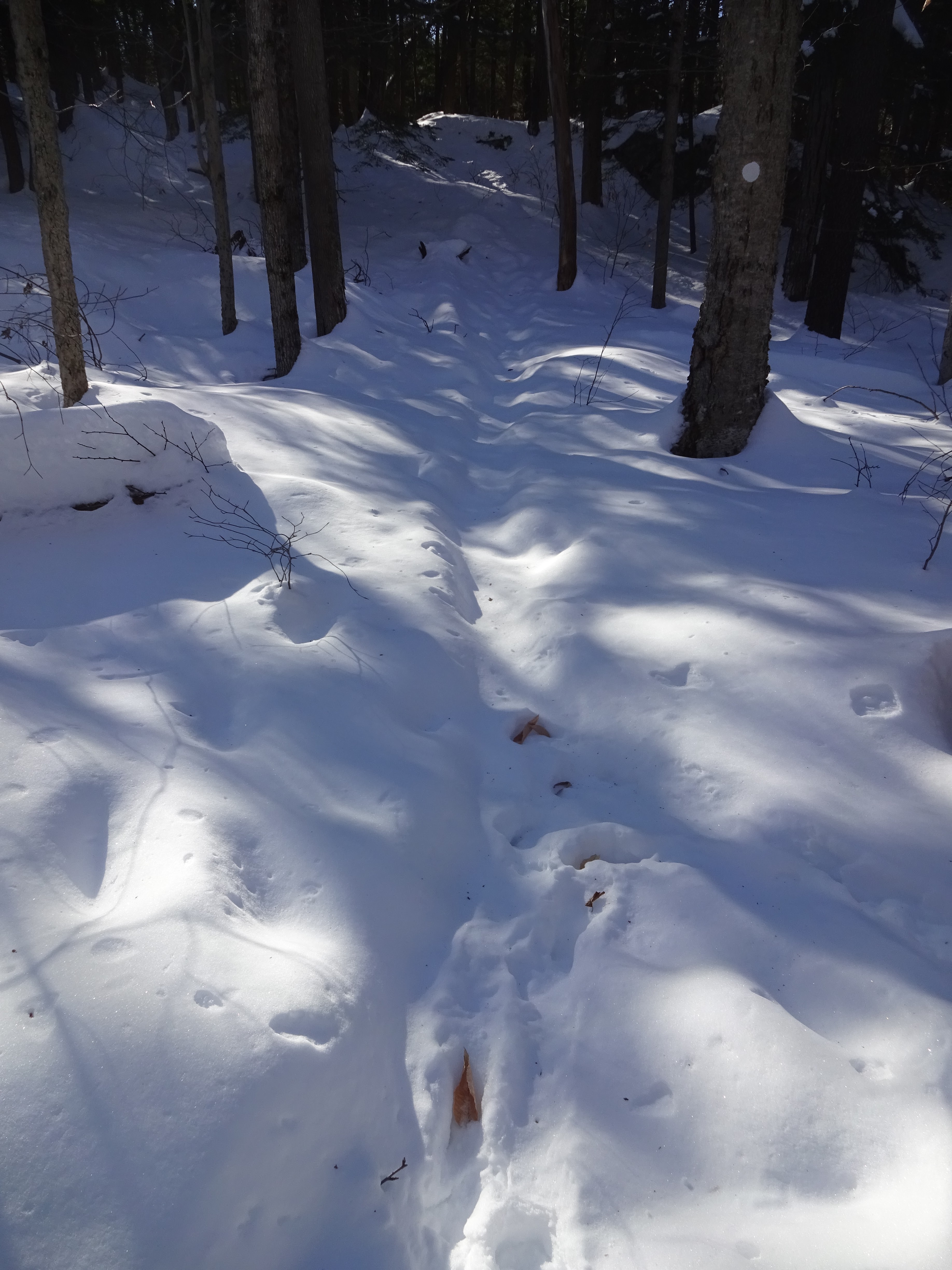
 It is very, very cold today.  It would be a good day to go skiing if it wasn't a Saturday.  There's still a couple of inches of snow on the ground at home so it would be a good day to go snowshoeing if my snowshoes weren't broken or in the shop.  So I decide it is a good day for a winter hike to try and check another Trustees property off my list.

The objective today to get out, hopefully avoiding people and references to Covid-19.  If I go east, there will be more people, so I'll head west.  I decide on Bear Swamp out in Ashfield, MA.  The most recent snowstorm had us here in Central Mass as the "sweet spot" of the storm, so I expect there might be a little less snow where I'm going.  I take my micro-spikes just so I am prepared.


Here's the temperature when I'm getting out of the car:  13 degrees ...

... and here's the property.  Wow!  That's more snow than I was expecting.


I know this picture at left is sideways (it was an accident);  however, it has one of the best views of how narrow the "packed" part of the walking trail was.  The picture at right gives you a sense of the depth of the snow.

I wouldn't want to be climbing up the rocks on the left, and fortunately, the trail is leading around them.


This is the northern terminus of the Lookout Trail. 
If I try to cross this field, my boots will "post-hole" into the snow.

Looking toward the north, an apple orchard can be seen in the valley.


The signage on the property is pretty good.  The trails were well marked.  I checked the map to see if there was an alternate way back, as I had experienced quite a few ups-and-downs getting to this point (see elevation profile at bottom).  The path shown in the right photo was another way around, but because it looked like it hadn't been trod in a while, I decided to find another route.

The alternate way back means I won't have to climb up here.

Once back to the car, I check the time and mileage and decide that I should explore a little more of the property.  Across the street from the entrance is another trail leading to this vista.

Looking off the northwest, I can view the same apple orchard that I saw earlier.

Beautiful Sunshine!


The distance today was only 2.7 miles with 413 ft of elevation.  Still, it was exhausting.  So the thing about winter hiking is this:  it's not about the distance, it's about the calories.


Monday, January 18, 2021

Rock House Reservation

Often, on the January MLK holiday, you will find me out in the woods for a snowshoe adventure.  This year, that activity wasn't possible for 2 reasons:  1) both my pairs of snowshoes are unavailable due to being broken and 2) there's no snow.  None.  The little that was left was washed away by this past weekend's rains.  The good news about my 30" snowshoes is that even though I bought the back in 2003, they carry a lifetime warranty.  Now I just have to wait for the Atlas Snowshoe Company to get some stock (customer service said they are completely out of stock due to more people staying at home this year).  My 25" snowshoes are in the shop in Milwaukie, Oregon undergoing repair.  You'd think there'd be a place closer to home for this, right?

Today's activity will be hiking.  Betsy is otherwise occupied on the last day of a 3-day virtual workshop, when means it will just be me out in the woods.  There's a Trustees property that I've been wanting to go to for some time, but since it's kind of out of the way, we just haven't made it out there yet.  The destination is Rock House Reservation in West Brookfield, MA.  I'm betting many of local friends don't even know where that is.  Suffice it to say, it's out there a ways.

While not a huge property, there are quite a few trails covering the interesting landscapes here.  I wound up covering quite a few of them.

It is actually a very nice winter day.  Temps in the mid-30's and the sun in shining.

Here's a winter view of the "Rock House".  It sits overlooking a pond.  It's mostly frozen since its average depth is only 3 feet.  The large boulder right in the middle of the pond gives a hint as to what I will be seeing today.

Holy Mackerel!  These are some BIG boulders.


It's a short climb up to the House itself.  Inside, there are some interpretive posters explaining some of the geology and history of this area.

Here's a view of the pond looking back down toward my starting point. 
I think this would be pretty in any season.

Look carefully and you will see a small boulder balancing on top of this other very large rock.
On Wachusett Mountain, we have our own version of this "Balance Rock."
 

While dropping a layer, I thought I would show off my new "YAY ADVENTURE" patch
that Matt & Becky had made for me.


I decide to check out the Summit Loop trail, only to find a part of it actually un-hike-able at this time.


These pics are amazing.  Almost artistic, with Mother Nature as the artist.  On the left, clearly there was a very strong wind that caused these trees to become uprooted and lean just so far.  The fact that they're at the same angle is what caught my eye.  On the right, a tree is caught in the branches of another tree, but it was so rotted the bottom literally fell off.

My hiking path turns out to be a bit of a figure-8 so here's a shot of me just below Balance Rock again.

The distance was not long today;  only 2.74 miles with an elevation gain of only 456 feet.  My hike lasted 1:18, but it was a beautiful day to be out.  Best of all, I've checked off one more property in my Trustees book.


Friday, November 27, 2020

Lehigh Gap Nature Center

It's Black Friday and time for another exciting adventure with Future Steve.  That's right!  We won't be going shopping on this trip, but rather out to the Lehigh Gap Nature Center near Slatington, PA.

As you may know, the Appalachian Mountains are composed of a series of ridges.  Over time, various forces, including rivers, cut "gaps" through these ridges.  This is especially apparent in many parts of Pennsylvania.  In this case, the Lehigh River cuts a gap through the Kittatinny Ridge, which extends from the Delaware Water Gap in the northeast to the Mason-Dixon line west of Harrisburg.  Much of this ridge is also known as Blue Mountain along its length.  In fact, the Kittatinny and Blue Mountain Tunnels on the PA Turnpike (I-76) also bore through this ridge in Franklin County.   In addition, the Appalachian Trail (AT) also runs along the summit of this ridge for a good portion of its path through this state.

After I get boots and backpack on, I depart from the nature center around 10:56am. 
You can clearly see "the gap" in this blue sky photo. 

I will be climbing up this way.  The trail runs just above those rocks.

I start out along the Prairie Warbler and Woodpecker Trail and finally make it to the AT. 
The contour lines are not particularly prominent in the map at top, so
take a look at them on the official trail map below to see the climb I had to do.


Up on the AT, there's a nice shelter, but it's only available to through-hikers.  This couple were just two of the many others I met today who would rather be outside hiking than shopping.

This photo was taken at the top of the ridge, but you can see that there's not much of a view.


Starting to head down, the town of Palmerton is in the distance.

Along the river there are railroad lines and an old zinc plant, which is now an EPA Superfund site.

The trail surface varied widely from easy wooded
footpath to more challenging rock slabs.

Atop the red shale hill is the old Marshall Mansion,
built by a Civil War general and thought to be haunted.

Time for a lunch break.  However, at this table, your food will stay dry and shaded but you won't.

Here's the hill I just came down ...

... and the Lehigh River below me.


Is it a good day to go fishing?  I never realized how shallow the river was at this point.

The abutment in foreground is part of an old railroad bridge that crossed the river.  
The highway on the far bank was built in a lane-over-lane style to accommodate this bridge.
However, after all that work, the railroad bridge was not in use for all that long anyway.

This hike was advertised as 4.4 miles, which I thought was reasonable as I am recovering from a knee injury.  However, in the end, it was only 3.84 miles.  Nonetheless, I still would up climbing 1282'.  You can see it was pretty much straight up, then straight back down from the ViewRanger graphic, below.