It is a gray day, but the temps are right around freezing and it is raining intermittently. I still want to avoid people if possible, but I will turn south to see what I can find.
I start by vising Quinebaug Woods in Holland, MA. On the way there, I pass some parts of the Quinebaug river where I have paddled in the past (see April 21, 2019)
 |
| As I'm walking down the trail, I see this bright purple. It's too early to be flowers, for sure It turns out to be some garland, clearly added to make this a trail-side Christmas Tree. |
 |
| The trail is wide and accommodates not only hikers, but evidently cross-country skiers as well, |
 |
| I got back to my car and realized I had missed one of the landmarks of this property. The remnants of an old chimney on the hilltop. The house that was previously here must have had quite a view. |
On the map, you can see how I went back out to see the chimney, then came back an alternate way. Total mileage was only 1.25 miles gaining a total of 238 feet of elevation. This was not nearly as exhausting as my outing a couple weeks ago in 13°F weather.
In any event, using Google to navigate here from Quinebaug Woods was difficult at best. Taking the "shortest" way, it should only have been a 4 minute ride; however, the map software didn't take into account local road closures. Or worse, dirt/private roads. I had to go back into Sturbridge and get onto I-84 down to Exit 1. It was easy after that.
 |
| Just off the trail, one can see where some of the mining happened amid these large rock faces. |
 |
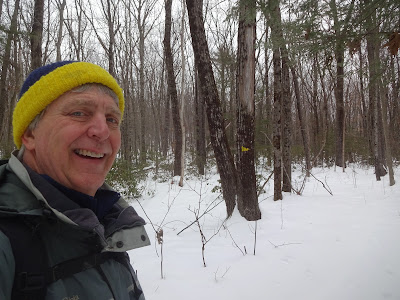
| This is my "Yes, it's me" photo to prove I was actually here. |
 |
| The way back took me to the top of a small ridge. There wasn't much a a view, but for 360° you can see Rhododendrons. |
 |
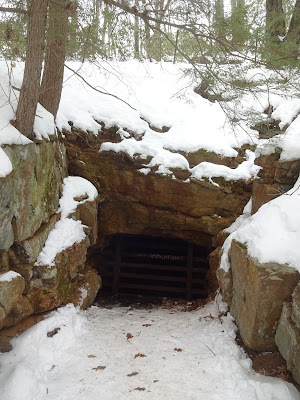
| I missed this on the way in (because I was chatting up another family of hikers). But this is an old mine shaft that they have gated for, presumably amid safety concerns. |
When I was done with stop #2, I briefly thought about making it a "three-fer" and hit Peaked Mountain in Monson, MA, a couple towns to the west. Ultimately, I decided that might be taking on too much. When I got home, I discovered that even though it's not in the blog, we visited that property back in October 2015. So it's already checked off my list :)


Glad we were there in October together - looks kind of frosty and gray in February.
ReplyDelete