Sunday, October 25, 2015

North-South Trail - Hike #4

It's been too long since I've been out on the North-South Trail.  To be sure, it was a very busy summer and so far, a busy fall, too.  The thing is, before this hike, I still had completed less that half the mileage of the trail.  It's time to get going!

Being mid October in Rhode Island, one would think there would be a lot of fall color to see, but with overcast skies dominating all day, there wasn't a lot of vibrancy.  Betsy was busy in Providence in the afternoon, so it was providential that she could drive 30 minutes when she was done to pick me up.  I had no company today, but I enjoyed the extreme quiet along almost the entire route.

To start the day, I taught Orienteering to Boy Scouts from Troop 85 Weathersfield, CT at the annual Scout-O at Nobscot.  At 9:30am, it was still only 45 degrees, so a fleece was absolutely required.  From there, I drove straight down to the access road to Stepstone Falls where the last hike ended.  I did not drive down to the falls themselves, recalling from last time how terrible the rutted dirt road was.
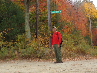

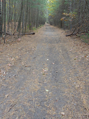
From the top of Falls River Road I'll hike down to Stepstone Falls. This is the road I wanted to spare my cars from.  The ruts and rocks get worse the further you go down the hill.

Here's the river just above the falls where Dominic was wading back in the spring.
I didn't realize at the time that I was hiking through an old ski area.  This was the parking lot
for Pinetop Ski Area back in the day.  Afterward, Betsy and I were both asking, "Where's the hill?"
Two small cemeteries across the street from each other. I visited the grave of one
"Rebecca , wife of Calvin Wilcox; died Aug 4 1862 in her 53 year.
These historic cemeteries can be found all over the Rhode Island countryside.

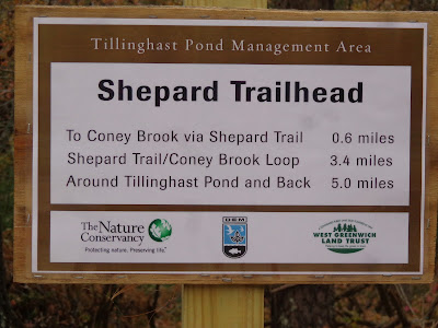
A ways down the road, I come across a managed conservation area.  The guide book reports this area as under the auspices of Audubon of Rhode Island.  While the sign shows the management evidently has changed, at least the area is still available for recreation.
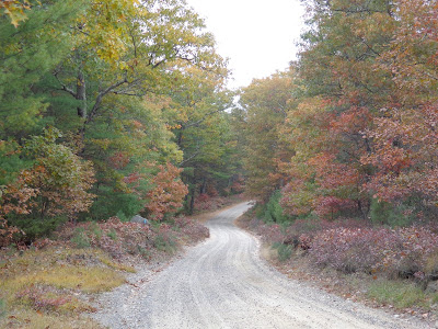
Very colorful with nary a sound to be heard.
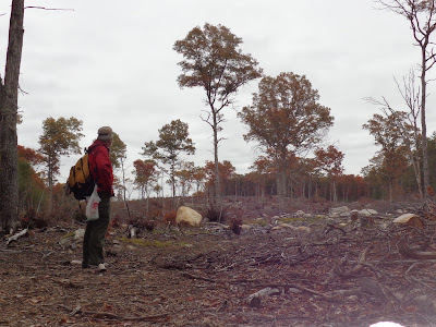
I'm standing 75' from the Connecticut border.  This logged out area goes back for a over 1/2 mile.
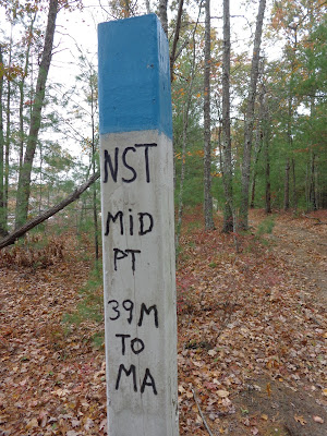
Now I'm officially halfway done with the North-South Trail as I'm passing by the cleared trees (back left).
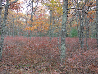
It was the ground cover (mostly blueberry bushes) aflame in this scene.
    
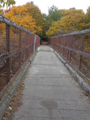
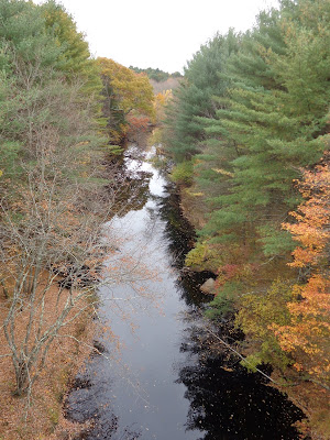
This was the most interesting feature of the hike.  This trestle is from an old railway line that was removed back in the 1960's.  If you look carefully down the old rail bed,  you can see the undulations in the trail surface.  I'm not sure what caused these unless it's just bike or 4-wheeler use.
The trestle itself is at least 30' above the water below, affording a beautiful view down the Moosup River.

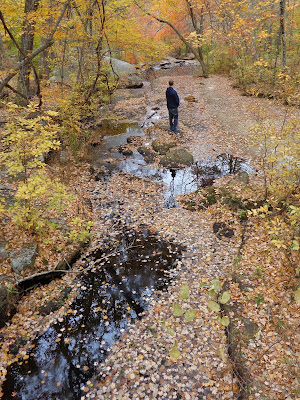
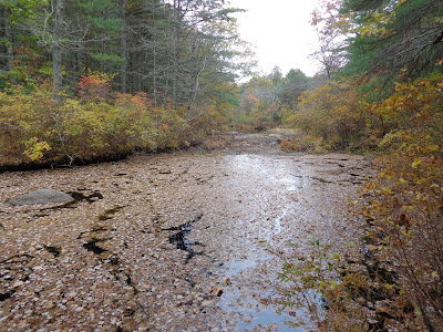
A little further on I find another leave-covered stream.

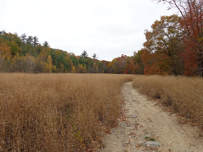
At last, I wide open field with some of brightest skies and most varied color of the day.

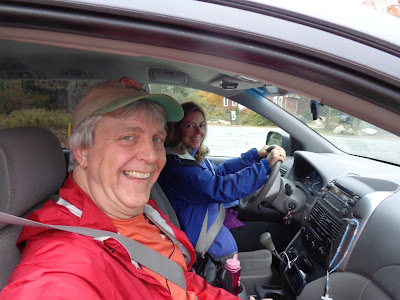
It was a long uphill walk to the my end point. Thanks, Betsy for picking me up.
I ended my day at the First Christian Church in the Rice City Historical District.  The Ladies Aid Society was having a church dinner.  Boy, did it smell good.  No wonder there was a line to get in.  Today's trail mileage was 10.28, but with the additional walk down to Stepstone Falls, the overall total was 10.90 in 3h50min.  Since I was by myself hiking on a lot of roads and I didn't want to be late for my pickup, I was moving at a pretty good clip.  Hopefully there'll be time and good weather to finish the rest this year.

Saturday, May 23, 2015

North-South Trail - Hike #3


"Three Day Weekend" - that's how I titled my invitation to my potential hiking partners prior to the Memorial Day holiday.  Yes, there will be ample time for family and yard work, but let's get a hike in first.  The forecast called for sunny weather, albeit slightly cool.  Perfect for a hike.

"Late, late, late" - that's what I said to myself as we started this hike.  Alex & I didn't start walking until 12:42 this particular Saturday, so considering we intended to cover almost 11 miles, it was going to be late afternoon until we finished.

What was nice, though, was getting more family time by having more of them join me.


At the start at Baker Pines Road.  Alex & I will start walking while everybody else will be heading for a nearby playground.  Dominic will be able to play Chutes and Ladders with Grammy, Uncle Nathaniel and Mama.  We actually had a false start.  About 1/10th of a mile down the trail I realized I dropped my guidebook so we had to head back for it.
Our first obstacle is Boulder Field, "an extensive area containing a seemingly endless number of boulders."  Formed by glacial outwash, there were several times I thought we were through it, but it just kept going.

Here's a glacial erratic.  Not as impressive as the Midstate landmarks Balance Rock and Sampson's Pebble, but pretty cool, just the same.

At Roaring Brook Pond, we cross an earthen dam (with boardwalk) while soaking in a marvelous mirror view.

Most of this part of the hike was unremarkable.  Alex & I were hiking very fast to make sure we would meet the rest of the gang on time.

At the break,, we had hiked 5.77 miles in just 2 hours, even with traversing the Boulder Field where the going was very slow.

     
Now, the rest of the hikers join us.  Nathaniel is out front with Betsy's trekking poles.       Alex, Cassandra, and Dominic followed.  Dominic likes to hike, but with his little legs, he has to take many more steps than we do.

This 4' high, 3' diameter precast concrete ring is actually a landmark in the hiking guide. What's it doing here so deep in the woods?

We meander along Roaring Brook.  In the distance you can see Betsy and others crossing the bridge.

We found a troll bridge here - Alex & Dominic under while Nathaniel crosses above.

Someone's obviously thought that the natural crack in the rock needed eyes and nose.

     
Rocks and water framed by the trees.       Betsy spotted this lady slipper beside the trail

We finally arrive at Stepstone Falls where we dropped our car over 4 hours earlier.

Dominic couldn't resist cooling his feet in the chilly water.
Mileage today was less than our my previous days at only 9.67 miles in 4:02 (plus .2 "stupid" miles for dropping my guidebook). However, it did include some hiking for everybody, chatting opportunities with some local fishermen and, best of all, precious family time.


Saturday, May 2, 2015

North-South Trail - Hike #2

Springtime comes to New England and there is just so much to do.  Especially after the exceeding harsh winter of 2015.  Nevertheless, I have chosen not to dedicate this particular Saturday no my yard, but instead to make some progress on my Rhode Island hiking goal.

I was getting some company on this trip, but since my partners would not be hiking the entire 11 miles with me, the logistics got really complicated.  Alex helps me spot my car at the end then drops me off at the start for the day.   The plan is for Betsy, Cassandra, and Dominic to join me about half way through after their morning activities.

It was a beautiful sunny day again with temps around 70°F. The drive down included a stretch on a scenic highway in Connecticut.

Here's the Meadow Brook Pond where I ended my last hike.  Like last time, lots of people are out fishing.  I'm smiling despite the fact that I forgot my water bottle in the car.  I will have a dry mouth for at least the next 5+ miles unless I find a convenience store or good Samaritan.
Apparently, this is the largest "field" on the North-South Trail.  Okay, then.
Here's the first of two historic Rhode Island cemeteries that I walked past today.  This one is in the middle of the forest and requires hiking boots to get to.
The hemlock path and the deep blue sky made for an enjoyable walk.
Just past the 5.6 mile mark, I take a lunch break.  Betsy and the gang are supposed to be meeting me here.  A quick phone call confirms they're a little behind schedule, so we arrange an alternate meeting place a mile or so down the road.

The guide book explains that the trail used to go through woodlands, but had to be re-routed along RI 138.  This is a very busy road and some the shoulder is not so wide.
We finally meet up.  Cassandra takes my backpack and I take on a little heavier payload.
We're still doing some road hiking, but at least it's scenic.  Cassandra, Dominic, and I stop by to chat with some cows.  Mooooo!
   
We passed this cute little pond, where someone obviously got creative and decided that some boats were needed.  They were tethered to the shoreline, but with the wind they actually moved around a bit.
There were no hills on this route until I put a 2-year old on my back. Clearly the steep hill we just climbed is composed of a substantial rock deposit, as this active quarry at the top attests.
Back in the woods, we give Dominic a chance to hike on his own.
We come out of the woods and pass under I-95.  Dominic's laughing because he thinks kicking Grandad from his perch in the backpack is funny.  Just 1/2 mile back to the car from here.
After retrieving the other car, we still have over an hour and a half to drive home.  The return route takes us by way of this turkey farm in Connecticut where we stop in for some homemade ice cream.  They even have a gluten-free waffle cone for Betsy.

Totals for the day:  11.01 miles for me and 3.93 for everybody else.  Overall trail time was 4:30.  While there was significantly more "road" time in this segment, we don't mind it so much; the ice cream is delicious.