Monday, October 29, 2012

Hike 13 - Section #13B

Sunday, October 28 - Hurricane Sandy is bearing down on the whole eastern seaboard (see local paper spelling error), but it's still a good day to get out for a hike.  Well, maybe.

This section of the hike goes mostly through Charlton and traverses the famous "cow tunnel" under 4 lanes of US Route 20 (Boston Post Road).  That was my pitch, anyway, to entice Betsy to join me on this stretch, in less-than-ideal weather conditions.  Driving to the start is now a bit easier because we are close to major highways once again (I-290, US 20).  To get started earlier, we leave directly from church after Youth Ministry Band (YMB) practice. Once again, we jockey cars so that I have a little longer hike  and Betsy joins me in the middle. I start walking at 1:52pm.


Betsy takes a photo of me through the car window back at Four Chimneys.  You have to look very carefully, but there are raindrops on the windshield.
Several parts of today's hike were over pipeline, which made for easy walking.
Some of the roads I was on are designated "scenic", apparently meaning narrow and winding, with lots of trees, but no views.
Lots of variety on this hike.This is the major east-west rail line from Worcester to Springfield.And somebody painted a welcome message for me on the bridge.


This appears to be a monastery or retreat center of the Coptic Orthodox Church of Alexandria, which separated after the Council of Chalcedon in 451 AD. It just seems odd that it should be behind such heavy security.

Betsy joins me after two miles.  It is still misty and drizzling a bit, but we're well prepared for weather.
You don't expect to see pink and purple leaves in the fall, but these almost match Betsy's backpack.
We make it to Rider Tavern, home to the Charlton Historical Society.
Across the street is a muster field, used well into the 19th century.  Betsy thinks I sometimes use my trekking poles as weapons, so I posed with them for this photo.
Passing over the Mass Pike, there's lots of westbound traffic evading the hurricane's path.  The rest area is in the distance.
This tree was being strangled by this heavy vine.
We finally arrive at the cow tunnel.  Inside, Betsy had an unfortunate fall because it seems someone left a bread-loaf size rock in the middle of the very dark path.
But we make it safely to the car, only another 0.1 mile away.


We were a little soggy at the end of 2 hours, 6 minutes, and 5.05 miles, but a Dunkaccino and hot tea on the way home really warmed things up. 

Saturday, October 6, 2012

Hike 12 - Sections #12 & #13A


Today's hike was an audible (that's football talk for "changed from the original plan").  You see, I was supposed to be hiking tomorrow, but the forecast for tomorrow afternoon is dismal.  And since Nathaniel (home for Columbus Day break) would rather chill than go to a Renaissance faire, my Saturday just opened up.

I recruit Alex to join me for this 6-mile jaunt.  Including "getting lost time" it takes us 1:10 to locate the cars before we start hiking at 1:12pm.  It is warm today, temperature in the mid 70's (unseasonable for October) and very humid.  With the exception of fall colors, there was very little of interest along our route today.  Most of the colors were yellows and quite a few of the trees had already lost all their leaves.  Like my last outing, this  hike is entirely in the town of Spencer.

Starting out on the south side of Rt 9.  The trail crosses just west of the Leicster town line (for those of you outside Massachusetts, we pronounce that "lester").
We hiked through some Mass Audubon property that had a trail system of it's own.
This photo reminded me of the Windows 7 wallpaper on my computer.
Once again, I saw wildlife along the way: Garter snakes slithering off the path, ducks in the swamp, and this colorful tree toad.
OK, this was not in the trail guide.  Apparently, a piece of the trail has been replaced by a handful of new houses and a new street named Candlewood Drive.
No matter what, when Alex hikes with me, we can't avoid swamps.  At least this one was colorful.
We get a break from the forest under some power lines.
Here's an actual re-route sign.  From here, we have to tread on private property.  Thanks to the homeowners allowing us passage.
The tail end of the hike had us walking local roads for about 2 miles.
We finish at the Four Chimney's Wildlife Area.
The trail underfoot at the beginning of this hike was very rocky and wet, making for slow going.  By contrast, at the end, we were entirely on roads.  The partly cloudy skies we started with gave way to dark and threatening ones, but we finished before any rain fell.  On the way back to my car, we drove on some of the same roads we had just hiked and also criss-crossed the trail a couple times.  It was like deja vu all over again.  Our totals for today:  time 2:07, mileage 6.59 miles.


Tuesday, September 25, 2012

Hike 11 - Section #10B & #11


September 23, 2012 - The watchword for today's hike was "variety".  This hike had a little bit of everything.  Moderate hills, sweeping meadows, a 4-H camp, people's backyards, driveways, wide trails, narrow trails, missing trails (?), as well as paved roads and even wildlife.

I hiked this section of the trail several years ago with the AMC, but it was in the opposite direction.  It was lucky I had, because at one point, the directions in the book were poor and the signage non-existent.  I lost the trail and had to rely on my memory of where I had hiked all those years ago. 

Yesterday was he first day of autumn.  Once again the weather was fabulous and, because it's getting cooler, the bugs were at a minimum.  It takes over an hour to position my car and I don't get started walking until 1:18pm.


On the shores of Browning Pond.  I'm going to have to bring my kayak here sometime.
Betsy helped me position my car, but doesn't have time to hike today. At this point, I'm hiking on the road, so she's hiking too - with the car!
Wildlife:  a Garter snake suns himself on the trail.
I remember hiking in this muck with the Scouts a couple times.  Thank you to the Mid-State Trail Committee for these trail improvements.
Just as I near the 4-H camp, look who's walking back to meet me.
  
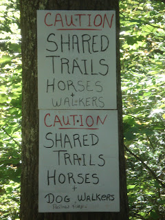
On the (extensive) 4-H property, I need to share the trail with others.   These horse trails were beautiful.  So much so, I missed two trail turns because I wasn't watching carefully enough.
These young ladies were out for ride. This first horse actually stopped to smile when I got out my camera.
  
This is the view from the top of Buck Hill.  Umm, yeah. And nearby, the Buck Hill shelter is undergoing renovations.
I wondered what the big, black area on the map was - the Spencer Airport.
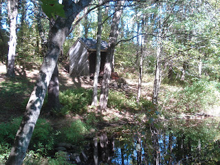
I make it to my second shelter of the day, on the way to Moose Hill.  This one is alongside a small pond.  It was a good place for a break with a PB&J sandwich.
Now, that's a cairn (over 3' tall).
The view from the top of Moose Hill - one of the prettiest vistas on the entire trail.
Here's where the trail disappeared.  Only later did I discover that there was an obscured sign saying "Mid-State Trail over top of dam."
This little single-track is actually the trail coming up from the dam onto the road.  The next trail sign is still 0.1 miles down the road (very hard to see at that distance).
Back at my car on busy Rt 9.  Notice the long shadows of late September.
Now I'm halfway through the town of Spencer, logging 8.2 miles in 3 hours and 15 minutes.

Sunday, September 16, 2012

Hike 10 - Section #10A


September 16, 2012 - The sky is crystal clear blue today.  It would be a shame to waste it doing chores around the house.  Betsy agrees to join me on my the next segment of my hike, as long as she can keep her part of the hike to around 3 miles.  No problem.  We just have to play some creative games juggling our cars. 

So I start where I left off two weeks ago on Crawford Street in Rutland, while Betsy waits for me where the trail crosses East Hill Road (Alex & I got lost driving around there on the last hike, so I was familiar with the area).  Now that these hikes  are starting further and further away from home, it takes a little more time to get to the start and to position our transportation correctly  Today, I don't actually start hiking until 2:40pm.  With the sun setting a little earlier each day, we wonder just how much time we have to hike.

Across the street from where Alex & I ended last time.  From here, I hike at "Leary-speed" for the first couple miles.
I didn't notice this shelter on the map, but it is in excellent shape with a fire ring in front.
I found this little tenting area next to Long Pond.
I pick up Betsy at East Hill Road.
This is the midway point on the trail:  46 miles to New Hampshire (been there), 46 miles to Rhode Island (yet to come).  Fortunately I have less that 46 miles to cover since we already did some hiking in Sutton (see map).
The trail opened up under the power wires allowing us to admire that azure sky.
This bridge over the boggy area is brand new, of varying widths, and wrapped with chicken wire   We are on the property of Treasure Valley, a Boy Scout camp of the Mohegan Council.
Yes, definitely a scout camp, with works in progress trail-side.
After passing a couple smaller glacial erratics, we finally make it Sampson's Pebble.  A big rock with a lot of graffiti.
Almost back at the car, here's a view of beautiful Browning Pond.
Ooops!  We almost forgot our end of hike photo.  Browning Pond in the background.
Originally, I had planned to hike all the way to the 4-H camp in Spencer, but it was already 4:48, so considering the ride back home, we figured we'd better call it a day.
I was on the trail for 2:18 covering 5.27 miles in Rutland, Oakham, and just the tip of Spencer.