Saturday, July 4, 2020

Lehigh Parkway

This recent issue of the AMC magazine had an article that highlighting less-crowded walking & hiking alternatives to some better known and popular hikes.  In Pennsylvania, a popular hike along the Lehigh River is Glen Onoko, a beautiful falls trail in Jim Thorpe, PA.  I have never hiked there, but Betsy did when she was younger.  As it turns out, the falls trail was permanently closed a year ago over safety concerns.  In any event, the author clearly didn't know that and provided a nearby alternative:  the Lehigh Parkway in Allentown.  Since I am in the area for the 4th of July holiday anyway, it seemed like an opportunity to check it out.

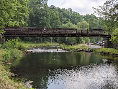
The directions in the magazine had me start at Klein's Bridge.  Try as I might I could find no indication (or even when I got there) of he name of the bridge.  I just took a shot that it might be near the Lehigh Runner's Club.  I took a shot and then moved on to the next phrase in the directions, "...follow the Dr. Ernest F. Andrews Memorial Planet Walk...".
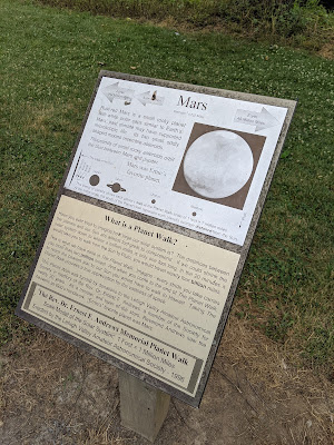

A "planet walk" is a scale representation of the distance between the planets in our solar system.  There is one along the Cape Cod Rail Trail in Eastham.  However, this one has information markers and the appropriate "planet" locations.

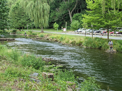
This trail hugs the Lehigh Creek.  Apparently the waters are excellent for fly fishing judging from the number of anglers I saw along the banks.

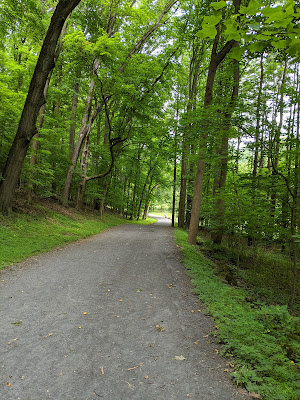
You wouldn't expect there to be hills on this trail, but at a couple locations it actually climbs and descends pretty steeply.

Next, I am told to cross under Bogert's Bridge.  In truth, you can cross under it on the other side of the creek.  On this side, you just pass by.
A little further on, I pass under I-78, a major east-west corridor in the Lehigh Valley.

So the directions got a little confusing here.  I passed a Museum of Indian Culture, but because of my approach, I never noticed it.  When this trail went to very narrow, I figured I went too far.

I crossed the road bridge and found the Lil'-Le-Hi Trout Nursery.

The directions next tell me to "retrace my steps."  However, I found that there was a complimentary path on the other side of the creek.  In fact, to the left of this path, there's another pave path available that road bikes can use.

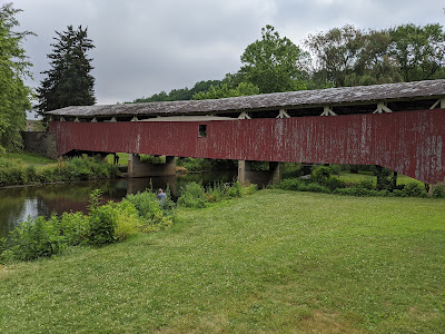
Finally, I make my way back to Klein's Bridge.  From this angle it's pretty impressive 

The article's stats for this walk was:  Difficulty:  Easy, Distance 2.6 miles round-trip.  However, it turned out to be a 4 miles walk (I wonder how they got those calculations wrong).  But I was moving at 3.3 mph, so it only took 1:12.  The best part of my walk today was greeting the other walkers, runner, and bikers along the path, 98% of whom observed physical distancing,but were unmasked, like me.  Sharing a friendly "Good Morning" and a smile does wonders for to lighten the heart.

Saturday, June 20, 2020

Friends with (Paddling) Benefits


It's been 1 year since our iconic trip to Alaska with our good friends Tom & Kay.  Since that time, they have moved to Marblehead from central Mass, and more importantly, have purchased a couple of sit-on-top kayaks to enjoy the seaside life.

I have paddled in this area several times before and was looking forward to a return visit.  We joined our friends in the harbor parking area at about 1:20pm on a hot Saturday afternoon.  We won't have to retrace out route or spot cars because our take-out is right across the street from our put-in.
Marblehead Harbor is as picturesque as any harbor in New England.

We don't really have a plan, but we paddle to the end of the harbor, then decide we can circumnavigate Marblehead Neck.
Why not?

Thinking it might be time for a little stretch break, we head for a nearby beach and hope the residents of the houses above are friendly.

It turns out, the guy at the pool at the top of the wall was friendly, so we're all smiles..
But it's time to head off paddling again.  This is my only photo with all 4 kayaks in frame.

Betsy with downtown Boston in the background.  Is this sufficient "social distance"?
One more turn around the lower corner of the neck, then we're heading for home.

Betsy & Kay are in the home stretch paddling into Devereaux Beach.
Our total paddling distance was 4 miles in about 2:10.  It was a wonderful way to spend a hot summer day in New England.  After arriving back at the beach, we loaded up the boats and headed to the house.  That in itself would have been a fantastic day, but it only got better when we ventured out to the Barnacle Restaurant for a late lunch.  "Cheers!"  to good friends.

Sunday, June 7, 2020

Family Hike

We had a map, but I forgot to turn on the tracking for this early summer hike in June.  Tanks to Mass DER, I was able to copy of portion of the Wachusett Mountain Reservation hiking trail map to show you where we went.

We park our car at Administration Road at the mountain's south side and set our sights on the Echo Lake and High Meadow Trails.  Hopefully, it won't be too strenuous on anyone. 

From High Meadow, we head down via the Jack Frost Trail.  As you can see by the contour lines it was a little steeper than I remember, but also sill a long ways from the summit.

Somebody doesn't need to take a nap and is raring to go!

When my kids were little, we did not have such fancy back packs.  They were held in by one flimsy little strap instead.

Yay!  First objective "Echo Lake" is met.

"Yes", we are definitely having fun yet.

So the High Meadow Trail is called that for a reason.  It was a bit of a climb to get up there.

Madeline thinks she's had enough of the backpack and would like to do a little walking too.

Saturday, April 25, 2020

You Can Still Get Out - Orienteering

Thank you New England Orienteering Club for helping me get outside and enjoy nature in the midst of the stressful times of COVID-19.  In fact, outside is one of the best places to be, as it turns out:

Running and walking outside are some of the safest activities people can do right now, “assuming they follow the actual social distancing guidelines,” Dr. Aaron E. Glatt, chairman of the department of medicine and hospital epidemiologist at Mount Sinai South Nassau tells CNBC Make It.

While there still aren't that many people out, I am undeterred.  With the NEOC's BYOM (Bring Your Own Map) format, which utilizes a QR Code reader application on my phone, one can enjoy the challenging experience of Orienteering without the worries of conforming to a strict schedule of start times.  In fact, NEOC held multiple BYOM events this spring at Nobscot Reservation in Sudbury and Hale/Powissett Reservation in Westwood.  

Orienteering is done in the wood where it is easy to keep safely physically distant from people.


Small orienteering controls are hung without the usual card punch or electronic readers, but rather a plastic-bagged paper displaying the control id and a QR Code.

At Nobscot's April 4-12 event, was able to do the Yellow course one week with Betsy and attempted the Orange course the following week as well
(click on the link above and search for "Fiedler" to see my results).

The following week, I headed down to Hale Reservation.  I did an Orange course and the locations on the map were shown as just symbols (without text).  I finally figured out what the symbol for this control was - "pit".  Boy! -- was that one hard to find.

That event ran from April 18-26, so I did an Orange one week and Yellow the next.  My results are here, but you have to search for "Steve" because I spelled my last name wrong.


The lake on this reservation is beautiful and has a couple beaches as well.

This is New England for you.  There's still snow in the woods in late April.
Finally, I returned to Nobscot for the course set up by the Juniors on May 9-24.  One weekend I did a Brown course, another weekend I did the Orange course, and on the third weekend, we took the grandkids to do a Yellow course.  Dominic navigated most of the way.  You'll only see 2 entries for "Fiedler" in the results, as I messed up in my registration of the Yellow course.  Our results can be found of you search for the name "No".  If you view the split times, you will see we took a nice long break between control 8 and 9 to eat our lunch.

Hope you have as much fun getting out as we do.

In front on Nobscot's parade ground, we're ready to go


Saturday, October 19, 2019

Batholomew's Cobble


Today I was reminded that fall is the best season for hiking.  We had an opportunity today to go hiking with the Brooklyn side of the family.  After spending a getaway night in the Berkshires, Matt, Becky, and Madeline joined us for an outdoor adventure in extreme southwestern Massachusetts.  The location is Bartholomew's Cobble, a Trustees of Reservations property.  Since we're already members (and often take advantage of our membership at Crane Beach), we thought it would be nice to explore one of the other properties on their extensive list.

Once we settled on location, Matt did some research and planned the perfect hike for us.

Despite what the website said, the visitor's center was closed.  So, after a few adjustments, we start out along the scenic trail.  Matt had done some research and had a plan for the hike.
We walk alongside the Housatonic River which snakes back and forth here.
 The river is running pretty high right now due to some recent rains.


Madeline's having a grand time riding on Daddy's back.
There were interpretive signs along some portions of the trail.

Almost everybody in this "selfie".
In this "selfie", I include the "Rock Outcrop" which is noted prominently on the trail map.

It's not the Rockies, but there are actual mountains in the Berkshires.  
Usually one  step OVER a log that has fallen across the trail.

It's a little after 12pm at this point, and you can tell by the length of the shadows that's its autumn.
Lots and lots of fallen leaves getting stuck on the end of my trekking poles. 


This is a long path up to Hurlburt's Hill.  Grasshoppers were jumping in front of our shoes with every step.

The payoff for the climb is this great view.

With a panorama  photo, you get an even better sense of the expansive landscape.

This photo shows color and suggests texture as well.
We take a rest and snack break at the benches on the hill top.  About 50 meters behind us is the Connecticut state line.
Feeling good at the top of the hill.
 After our break, we have a straight-line walk back to the visitor's center and our car.  The hike is a modest 3.27 miles done in 2:11.  With the climb up Hurlburt's Hill, our total elevation gain as 682'.


The parking lot at the visitor's center was quite full when we arrived back.  We pack up and head into Sheffield for a late lunch.  Matt's chosen Bash Bish Brew & Que, a small establishment on the main street.  The atmosphere was laid-back and the food was very good:  brisket, pulled pork, greet beans, cole slaw, and local beer.  Betsy brought gluten free German Black Forest cupcakes to celebrate Matt's birthday.  A fitting end for a beautiful fall day in the Berkshires.