Saturday, April 23, 2016

North-South Trail - Hike #7

It's time to buckle down and finish up my North-South Trail hike in Rhode Island.  There are almost 14 miles to go, but I've decided to break it into two separate outings.  Ideally, I would like to find a hiking partner, but at a minimum, I need some help shuttling the car.  This stretch will be a little over 8 miles, a great warm up for hiking season.  Luckily, Tom was available to hike (and he likes to drive), so that made things easy (and more enjoyable).

It rained last night, so there is some residual overcast today, but the temps are predicted to be ideal, around 60 as the weather improves from northwest to southeast.  I had to do some careful planning time-wise, because at the end of the hike, I will get Dominic for the rest of the day while his parents take in a concert at Providence College.

Tom & I drop my car at where Brian and I finished last fall.  We start hiking at 10:45am.
The trail first took us into the George Washington Wildlife Management Area.  Within it was the George Washington Campground.  The camping sites are refreshed and ready for the season.  The sites were spacious and were not on top of one another.  It would be a nice place for camping.
Along the camp road, there was this building site.  It looks like they are building a new bath house or lodge.  Unfortunately, at this point, we got caught up chatting and looking around, so we missed our turn and walked an extra 1/4 mile down the road before we realized we were off the trail.
We returned to find where we lost the trail (just past the building site).  It led down away from the road to a beautiful lakefront with a beach.
Just past the beach, the North-South Trail joins the management area's Walkabout Trail   The Walkabout Trail is a loop trail consisting of 3 branches of varying length and color (1.73mi, 4.86mi, 7.83mi).
Here's just a couple of the glacial erratics along Walkabout Trail orange/red/blue.
We also passed a lot of pretty ponds.  With no leaves we could actually see them easily.
As you can see, we've left behind the orange and blue branches of the Walkabout Trail.
This was one of the easier streams we forded.

It's my turn to be in a picture with a pond.  
This is the earthen dam holding that pond shown above.  The water seeps by, but lucky for us, we can walk across these beams to the top of the dam for a nice lunch break.
This feature we couldn't quite figure out.  It looks like a foundation filled with water, but it also has an exit for the water, almost as if it was designed to hold the water.  In the reflection, you can see we've finally gotten our blue skies.
This obviously was just somebody having fun making cairns, as the trail really doesn't need them.
Just a little road walk and we're back at Tom's car.
Today's hike had a higher trail-to-road ratio than any other section of the entire trail thus far.  Only the last mile was on-road.  In addition, there was considerable elevation loss/gain, especially for Rhode Island.  Consequently, my time estimate for the hike completion was a little off.  Nonetheless, we did hike 8.22 miles in 3h17m meaning we still averaged over 2.5 mph including breaks. This was actually the shortest section I've done on this entire trail, but by no means the easiest.  After driving back to pick up my car and my grandson, we headed home.

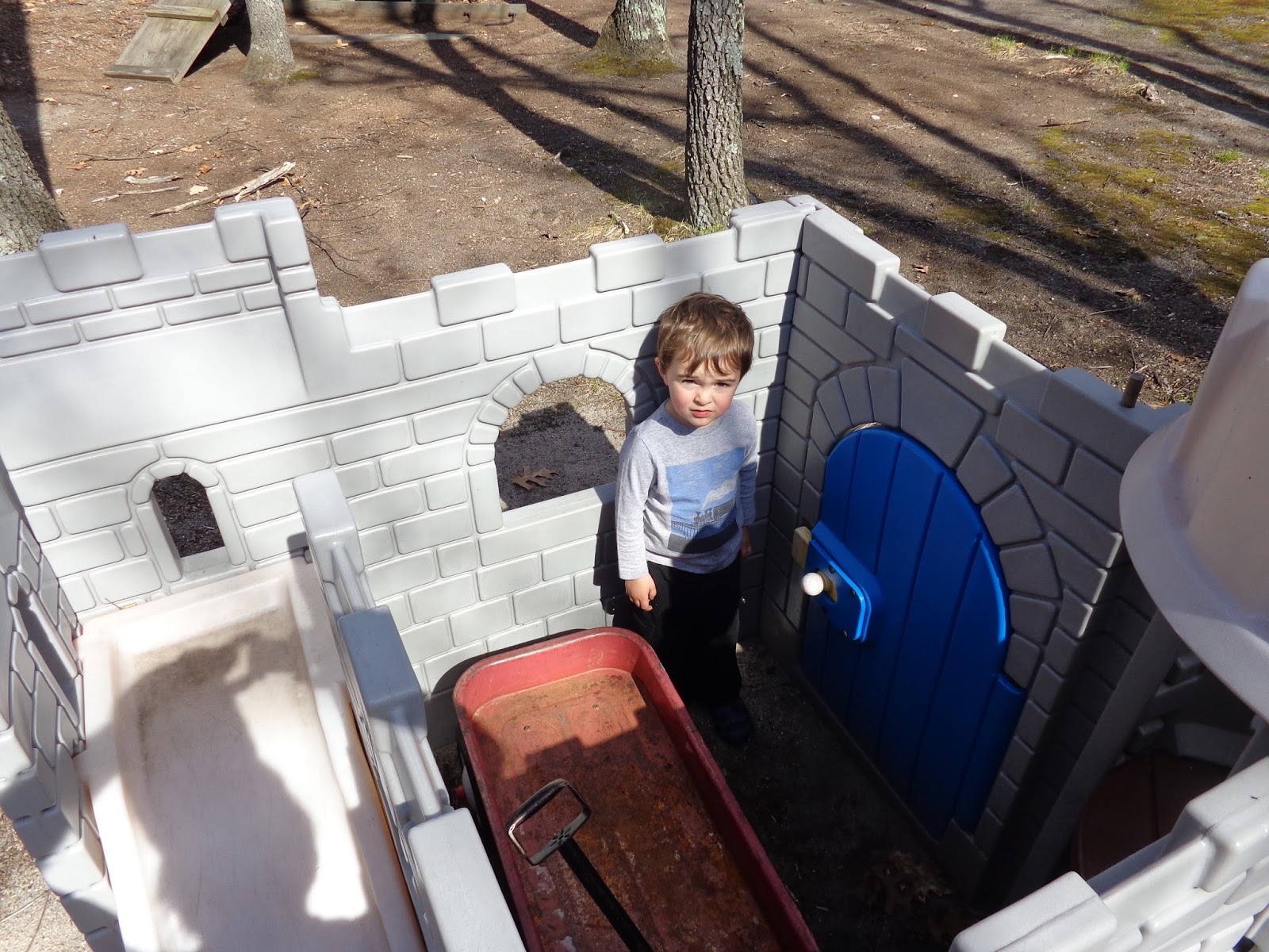
He kept me busy the rest of the day.  How exactly did he get that wagon in the castle anyway?
Then next hike will be the final one for this trail.  Join me if you can.

Saturday, April 16, 2016

AMC Paddle: Quinebaug River-Southbridge to W. Thompson, CT

It's springtime and paddling season has officially begun.  The forecast for today was sunny with temps in the mid-60's.  Of course the temperature in the water would be much colder, requiring a layer of neoprene, just in case.  Fortunately, nobody fell in.

I had never paddled the Quinebaug River, so I was looking forward to this trip, especially since we would start in Massachusetts and end in Connecticut. All told, there would be 8 paddlers in 2 canoes and 4 kayaks.

We start our day in the Big Y Supermarket parking lot.  Dick and Dave will be in the lead canoe.

I take a quick look at the put in and catch my breath.  That water is moving pretty quickly.  That set the stage, because there was plenty of quickwater on this paddle.  I took a video (below) to give you a sense of the rushing water.

There were two planned portages on this trip.  At this point I am pulled over into an eddy looking upstream at our first unplanned portage.  There was no getting around that tree across the river.

We made it to our first planned portage at the south end of the Quinebaug River Reservoir in West Dudley (the next town over).

Looking downstream, the river is beautiful.

Looking upstream, you can see the dam beyond the bridge (which is why we had to portage).
We chose to lunch in the quiet along the riverbank rather than near the noisy road at the next portage.  Elaine, Abby, Pat, and Ed all dig out their lunches.

The bank was grassy as opposed to muddy and there was plenty of room for boats and people.

I wanted to get a picture to show you I really was paddling down the river, but I only took my camera out when the current slowed.  It was a long stretch of paddling after lunch and by this point all the quickwater was behind us.
The river emptied us onto West Thompson Lake in Thompson, Connecticut. If you look carefully, you can see 3 of the other boats working their way to where I am, at the boat launch.   We traversed a little more than 1/2 the lake to get to this point, but it continues to the dam to my left.

I thought I read that this was a "leisurely 7 mile paddle".  Clearly, I have to stop skimming and read more carefully.  The total distance was 12.06 miles and we were paddling about 4:37 (including portages, but not lunch).  It was 62 degrees at 3:20pm when I arrived at the take out, and as you can see, the day ended as beautifully as it began.

Saturday, November 21, 2015

North-South Trail - Hike #6

There weren't many interesting things to see on this hike, but at least I had some company.  Brian was finally able find a slot in his busy schedule and was feeling healthy enough to join me in this nearly 10+ mile segment.

The day was picture perfect, albeit a little chilly.  We were under a crystal clear blue sky the entire day and got started early for a change:  10:16am.  Check out the map carefully; you'll notice that the trail actually takes a jog into Connecticut.  Yes, Rhode Island is so small that they can't even fit in the entire North-South Trail.  

With trail guide in hand, we're ready to start down the trail.  Er, actually it's a road at this point.
At the end of Shippee Schoolhouse Road, there's a bell from the old schoolhouse - 1829-1918.
We cross US Route 44 and as we do, we cross into Connecticut.
This is Killingly Pond.  Along the road, there are multiple "No Parking" signs on the chain link fence guarding the pond.
We get another glimpse of the pond, at its far end.  I think it was just about here that we crossed back into Rhode Island, but with no signs on the trail, we weren't really sure.
Much of our hike today was spent on ATV trails - fairly wide with a lot of loose scree.
I'm standing near an old entrance to Oak Leaf Family Campground,
the  highest point on the North-South Trail, just over 800' above sea level. 
Several people have asked me, "Why are you walking uphill through Rhode Island?"
Yes, this tree is really dead and judging by the two big pink "X" markings, it should really come down.
About 1:15pm, we finally found a nice spot to take a lunch break.
Nothing extraordinary, but you can still see the azure sky reflected in the water.
Now this is what I call relaxing in the woods!
A few minutes later we were back at my car.  We covered 10.73 miles  in 4:10 (including breaks) for an average speed of 2.57 mph, but more impressive, we actually finished before 2:30pm.  Which is a good thing because you can see how long these shadows are.  The ATV trails were plentiful comprising about 65% of the path vs 32% gravel/dirt roads and only about 3% single-track hiking trail.  The only other "interesting" thing the guide book called out was how many different watersheds we traversed, which gives you an idea of how much up-and-down we were doing.  There's only one more town to go through and I anticipate two more hikes and I'll be done.

Saturday, November 7, 2015

North-South Trail - Hike #5

We were trying to come with a name for today's hike.  At one point the title "Non-Wildlife Hike" seemed appropriate. Another option might have been "Lotsa Roads".  In any event, with unusual November temperatures in the upper 50's, it appeared to be a great day for a hike.

Ahead of time, I knew that this was not going to be a particularly interesting hike.  I've been using Google "street view" to actually examine the hike route, so I was expecting a lot of roads.  I certainly found them.

Thanks so much to Alex for joining me today and helping with the car shuttle. The parking lot at our starting point, the Rice City Community Church, was busy this morning just like it was when Betsy picked me up two weeks ago.  Then it was a church supper; today it was a craft fair.

Beside this church, there are two historic schoolhouses; one from 1812 and one from 1846.
This Rhode Island historic cemetery occupied a prominent hilltop location. 
In total, we passed 4 cemeteries on this trip.
This is horse country in Rhode Island.  These guys were looking for company or a snack, but knew well enough to stay back from the electrified fence. 
Yeah, lots of roads, but at least there were plentiful bucolic vistas, too. 
The trail went right past the Foster Country Club.  These golfers were teeing off at the first hole.
This was actually noted in the trail guide. 
The sign on the telephone pole across from this entrance just said "D W N C -->";\.
That's an abbreviation for Dyer Woods Nudist Campground.   Peering down the driveway, I saw that the gate to the campground was actually open.  I guess even nudists need firewood.
This was a highlight.  In addition to the many horse farms we passed, there was also this alpaca farm.  These juveniles watched us for a while with curiosity, then wandered away.
This is definitely non-wildlife.   This truck/crane was loading lumber from a newly cleared field.
There's plenty of traffic along Danielson Pike, aka The Grand Army of the Republic Highway,
aka  US Route 6, probably the busiest highway on the entire trail.
Apparently, the Shady Acres Restaurant and Dairy Bar is another landmark along the trail.  After this point, we met up with a small group people doing some trail maintenance and improvements.  They made sure there were lots of "North-South Trail" signs north of this point. 
Finally, a trail rather than a road. 
I think this rooster also qualifies as "non-wildlife" as well.  Decolores!
Returning to Rice City, our car was only one left in the lot
It was an ambitious hike today:  11.83 miles in 3:44.  That's an average speed of 3.17 mph including breaks (the fastest I've recorded).  Our feet were quite tired at the end of the day as there was a lot of hard pavement.  We figured:  48% paved road, 45% dirt road, and only 7% wooded trail.  Now there are just over 20 miles to go to finish.  If the weather holds out, I might finish it before Christmas.  Join me if you can!